Category:Maps of Anguilla
Wikimedia category | |||||
| Upload media | |||||
| Instance of | |||||
|---|---|---|---|---|---|
| Category combines topics | |||||
| Anguilla | |||||
British Overseas Territory in the Caribbean   .svg) | |||||
| Instance of | |||||
| Part of | |||||
| Location | British overseas territories, UK | ||||
| Capital | |||||
| Legislative body |
| ||||
| Official language | |||||
| Anthem | |||||
| Currency | |||||
| Head of government |
| ||||
| Population |
| ||||
| Area |
| ||||
| Top-level Internet domain | |||||
| Different from | |||||
 | |||||
Subcategories
This category has the following 8 subcategories, out of 8 total.
!
*
- Topographic maps of Anguilla (3 F)
C
E
- Election maps of Anguilla (4 F)
F
- Flag maps of Anguilla (3 F)
M
S
T
- Travel maps of Anguilla (2 F)
Pages in category "Maps of Anguilla"
The following 2 pages are in this category, out of 2 total.
Media in category "Maps of Anguilla"
The following 31 files are in this category, out of 31 total.
-
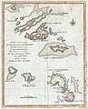 1781 Lodge Map of St. Bart, Anguilla, St. Martins, Leeward Islands, West Indies.JPG 1,200 × 1,488; 1.48 MB
-
 20170904 IRMA TC-MODIFICATIONS.pdf 1,754 × 1,239; 1.07 MB
-

-

-
 Angilja be.png 675 × 381; 46 KB
-
 Flag-map of Anguilla.png 725 × 339; 17 KB
-
 Anguilla islands-ar.svg 1,694 × 851; 325 KB
-
 Anguilla islands.svg 1,694 × 851; 80 KB
-
 Anguilla location map.svg 1,777 × 1,604; 56 KB
-
 Anguilla map mk.svg 8,669 × 4,128; 973 KB
-
 Anguilla map.jpg 1,879 × 1,408; 865 KB
-
 Anguilla Map.png 720 × 540; 7 KB
-
 Anguilla map.svg 8,669 × 4,128; 975 KB
-
 Flag-map of Anguilla UK.png 429 × 211; 9 KB
-
 Anguilla w2 locator.svg 1,000 × 1,000; 216 KB
-
 Anguilla With names.png 1,506 × 839; 344 KB
-
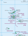
 Anguilla-St-Martin-St-Barthélemy.png 383 × 249; 156 KB
-
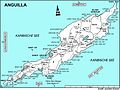
 AnguillaDistrictsMap.png 4,540 × 2,525; 407 KB
-
 ECDM 20141014 LatinAmerica.pdf 1,625 × 1,125; 570 KB
-
 ECDM 20150826 Caribbean TC.pdf 1,625 × 1,125; 653 KB
-
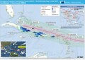
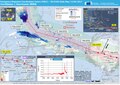 ECDM 20170906 IRMA TC UPDATE.pdf 1,754 × 1,239; 805 KB
-
 ECDM 20170907 IRMA HURRICANE.pdf 1,754 × 1,239; 945 KB
-
 ECDM 20170911 IRMA HURRICANE.pdf 1,754 × 1,239; 1,017 KB
-
 Karibik 25.png 1,343 × 784; 596 KB
-
 Karibik 27.png 1,350 × 781; 767 KB
-
 PAT - Anguilla.gif 800 × 1,025; 47 KB
-
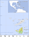
 Saint Martin Map.png 527 × 678; 77 KB
-
 SSS Islands Map (cropped and centered to Anguilla Channel).png 527 × 493; 69 KB
-
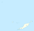
 SSS Islands Map.png 527 × 678; 88 KB
-
 SSS Islands Map.svg 527 × 678; 94 KB
-
 TheValley.gif 2,130 × 3,366; 167 KB

.jpg)


.png)


