Category:Maps of Battle of Arras (1917)
English: Maps showing Battle of Arras in France , 1917.
Wikimedia category | |||||
| Upload media | |||||
| Instance of | |||||
|---|---|---|---|---|---|
| Category combines topics | |||||
| Battle of Arras | |||||
1917 British offensive during the First World War  | |||||
| Instance of |
| ||||
| Part of | |||||
| Location | Arras, arrondissement of Arras, Pas-de-Calais, Hauts-de-France, Metropolitan France, France | ||||
| Point in time |
| ||||
| Start time |
| ||||
| End time |
| ||||
| Different from | |||||
 | |||||
Subcategories
This category has only the following subcategory.
V
Media in category "Maps of Battle of Arras (1917)"
The following 39 files are in this category, out of 39 total.
-
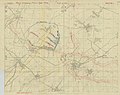 1 ANZAC Corps Battle of Bullecourt objectives map.jpg 2,591 × 2,053; 1.46 MB
-
 26. R.D. Arras 1916.jpg 694 × 471; 112 KB
-
 26.Res.-Div. August 1917 Bullecourt.jpg 384 × 400; 74 KB
-
 5th Australian Division operations 17 March - 6 April 1917.png 584 × 525; 497 KB
-
 2nd Division, Arleux, 28-29 April 1917.jpg 906 × 636; 168 KB
-
 2nd Division, Battle of Arleux, 28-29 April 1917.jpg 965 × 704; 164 KB
-
 Arras and Vimy ridge features.jpg 966 × 1,474; 911 KB
-
 Arras-Cambrai area, 1914.jpg 973 × 607; 297 KB
-
 Artois A.jpg 978 × 1,462; 571 KB
-
 Artois B.jpg 977 × 1,460; 576 KB
-
 Artois, northern France.jpg 907 × 698; 428 KB
-
 Battle of Arras (1917).jpg 981 × 1,231; 217 KB
-
 Battle of Arras - First Army communications map.jpg 1,981 × 2,286; 1.24 MB
-
 Battle of Arras - Map showing British advance on the Arras front.jpg 2,198 × 3,001; 1.27 MB
-
 Battle of Arras, April 1917.PNG 313 × 477; 244 KB
-
 Bullecourt, 1917.jpg 610 × 545; 141 KB
-
 Bullecourt, late 1917.jpg 441 × 320; 44 KB
-
 Bullecourt-Cambrai, 1917b.jpg 469 × 469; 77 KB
-
 Capture of Fresnoy, 3-4 May, 1917.jpg 803 × 1,239; 306 KB
-
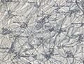
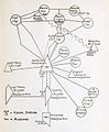 Diagram of trench communications, Hill 70, November 1917.jpg 1,193 × 1,446; 170 KB
-
 Fresnoy, 3-4 May, 1917.jpg 708 × 633; 208 KB
-
 German defences around Oppy Wood, early 1917.png 724 × 1,171; 1.73 MB
-
 German retirements Somme 1917.png 800 × 1,232; 778 KB
-
 High ground, Artois.jpg 913 × 713; 224 KB
-
 Junction of Siegfried and Drocourt-Queant lines, 1917-1918.jpg 878 × 666; 228 KB
-
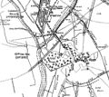
 La Coulotte, 14 April 1917.jpg 795 × 595; 121 KB
-
 Lens area, 1917.jpg 883 × 732; 287 KB
-
 Lens district, 1917.jpg 374 × 432; 81 KB
-
 Lens district, 1917b.jpg 622 × 520; 151 KB
-
 Map of Nauroy region with detail and trenches revised to 3-11-1917.jpg 2,200 × 3,000; 1.51 MB
-
 Mappa delle battaglie di Arras e Messines.jpg 1,600 × 1,237; 191 KB
-
 Operations around Arras, 1914-1915 (mich Arras).jpg 1,036 × 1,554; 342 KB
-
 Operations around Arras, 1915-1918.jpg 1,031 × 1,530; 323 KB
-
 Siegfriedstellung defences 1917.png 552 × 499; 244 KB
-
 Siegfriedstellung defences, Bullecourt, 1917.jpg 610 × 545; 129 KB
-
 Topography of the Arras-Lens area showing ridge lines.jpg 860 × 1,314; 722 KB
-
 Usma battle of arras 1917.png 970 × 1,496; 352 KB
-
 Western Front 1917.jpg 1,242 × 961; 228 KB
-
 Western Front, April 1917.jpg 415 × 737; 106 KB


.jpg)


.jpg)


