Category:Maps of Brion (Isère)
Wikimedia category | |||||
| Upload media | |||||
| Instance of | |||||
|---|---|---|---|---|---|
| Category combines topics | |||||
| Brion | |||||
commune in Isère, France  _OSM_01.png) | |||||
| Instance of | |||||
| Location |
| ||||
| Street address |
| ||||
| Population |
| ||||
| Area |
| ||||
| Different from | |||||
| official website | |||||
 | |||||
Media in category "Maps of Brion (Isère)"
The following 7 files are in this category, out of 7 total.
-
 38060-Brion - Localisation.png 2,480 × 2,480; 1.24 MB
-
 38060-Brion-Cadastre.png 7,015 × 4,960; 4.85 MB
-
 38060-Brion-Hydro.png 7,015 × 4,960; 2.98 MB
-
 38060-Brion-Sols.png 3,270 × 2,598; 1.43 MB
-
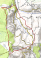
 Brion (Isère) OSM 01.png 407 × 580; 89 KB
-
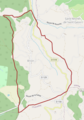
 Brion (Isère) OSM 02.png 407 × 580; 213 KB
-
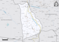
 Map commune FR insee code 38060.png 756 × 605; 38 KB


_OSM_02.png)
