Category:Maps of Burlington County, New Jersey
Wikimedia category | |||||
| Upload media | |||||
| Instance of | |||||
|---|---|---|---|---|---|
| Category combines topics | |||||
| Burlington County | |||||
county in New Jersey, United States    | |||||
| Instance of | |||||
| Named after | |||||
| Location | New Jersey | ||||
| Capital | |||||
| Inception |
| ||||
| Population |
| ||||
| Area |
| ||||
| Different from | |||||
| official website | |||||
 | |||||
Subcategories
This category has the following 4 subcategories, out of 4 total.
L
M
Media in category "Maps of Burlington County, New Jersey"
The following 38 files are in this category, out of 38 total.
-

-

-
 Browns mills cdp nj 005.png 600 × 580; 51 KB
-

-

-

-

-

-
-

-

-

-

-

-

-

-
-
-

-

-

-

-

-

-
 Country lake estates cdp nj 005.png 600 × 580; 51 KB
-
 Florence roebling cdp nj 005.png 600 × 580; 51 KB
-
 Fort dix res nj 005.png 600 × 580; 56 KB
-
 Leisuretowne cdp nj 005.png 600 × 580; 51 KB
-
 Location map of Burlington County, New Jersey.svg 896 × 768; 1.22 MB
-
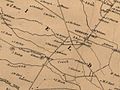 Mansfield Township 1859- panhandle.jpg 640 × 480; 57 KB
-
 Map of New Jersey highlighting Burlington County.svg 1,426 × 2,700; 61 KB
-
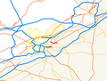 Map of NJ 90.png 1,780 × 1,350; 71 KB
-
 Mcguire afb res nj 005.png 600 × 580; 54 KB
-
 Moorestown lenola cdp nj 005.png 600 × 580; 50 KB
-
 Pemberton heights cdp nj 005.png 600 × 580; 51 KB
-
 Presidential lakes estates cdp nj 005.png 600 × 580; 53 KB
-
 Ramblewood cdp nj 005.png 600 × 580; 51 KB
-
 Road from Philadela. to New York, seg. 4-5. NYPL484166.tiff 4,121 × 4,121; 48.59 MB
_LOC_2012592357.jpg)
_-_Burlington_County_-_Burlington_County_-_ED_3-1_to_146_-_NARA_-_23853105_(page_2).jpg)

.png)


