Category:Maps of Canet-de-Salars
Wikimedia category | |||||
| Upload media | |||||
| Instance of | |||||
|---|---|---|---|---|---|
| Category combines topics | |||||
| Canet-de-Salars | |||||
commune in Aveyron, France   | |||||
| Instance of | |||||
| Location |
| ||||
| Street address |
| ||||
| Population |
| ||||
| Area |
| ||||
| Elevation above sea level |
| ||||
 | |||||
Media in category "Maps of Canet-de-Salars"
The following 12 files are in this category, out of 12 total.
-
 12050-Canet-de-Salars-Arron.png 3,057 × 2,480; 1.23 MB
-
 12050-Canet-de-Salars-cadastre.svg 961 × 744; 5.75 MB
-
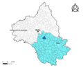
 12050-Canet-de-Salars-Canton.png 3,057 × 2,480; 1.26 MB
-
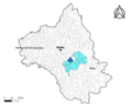 12050-Canet-de-Salars-EPCI.png 3,057 × 2,480; 1.26 MB
-
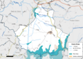 12050-Canet-de-Salars-Hydro.png 3,519 × 2,480; 2.01 MB
-
 12050-Canet-de-Salars-Natura2000.png 7,039 × 4,960; 3.96 MB
-
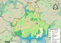 12050-Canet-de-Salars-Sols.png 3,507 × 2,480; 2.22 MB
-
 12050-Canet-de-Salars-ZNIEFF1.png 3,519 × 2,480; 1.77 MB
-
 12050-Canet-de-Salars-ZNIEFF1.svg 1,056 × 744; 7.1 MB
-
 12050-Canet-de-Salars-ZNIEFF2.png 3,519 × 2,480; 1.77 MB
-
 12050-Canet-de-Salars-Zone inondable.svg 1,070 × 744; 3.08 MB
-
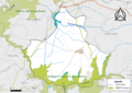
 Map commune FR insee code 12050.png 756 × 605; 45 KB


