Category:Maps of Cardan (Gironde)
Wikimedia category | |||||
| Upload media | |||||
| Instance of | |||||
|---|---|---|---|---|---|
| Category combines topics | |||||
| Cardan | |||||
commune in Gironde, France   | |||||
| Instance of | |||||
| Location |
| ||||
| Population |
| ||||
| Area |
| ||||
| Elevation above sea level |
| ||||
| official website | |||||
 | |||||
Media in category "Maps of Cardan (Gironde)"
The following 8 files are in this category, out of 8 total.
-
 33098-Cardan-argile.jpg 3,057 × 2,480; 387 KB
-
 33098-Cardan-relief.png 3,057 × 2,480; 2.19 MB
-
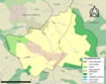
 33098-Cardan-Routes-Hydro.png 3,507 × 2,480; 1.19 MB
-
 33098-Cardan-Sols.png 3,270 × 2,598; 1.37 MB
-
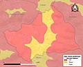
 33098-Cardan-ZNIEFF2.png 5,866 × 4,133; 4.2 MB
-
 Cardan (Gironde) dans son Arrondissement.png 2,000 × 2,467; 646 KB
-
 Cardan (Gironde) Limite communale.jpg 966 × 574; 170 KB
-
 Map commune FR insee code 33098.png 756 × 605; 36 KB


_dans_son_Arrondissement.png)
_Limite_communale.jpg)