Category:Maps of Caudiès-de-Conflent
Wikimedia category | |||||
| Upload media | |||||
| Instance of | |||||
|---|---|---|---|---|---|
| Category combines topics | |||||
| Caudiès-de-Conflent | |||||
commune in Pyrénées-Orientales, France   | |||||
| Pronunciation audio | |||||
| Instance of | |||||
| Location | |||||
| Head of government |
| ||||
| Population |
| ||||
| Area |
| ||||
| Elevation above sea level |
| ||||
 | |||||
Media in category "Maps of Caudiès-de-Conflent"
The following 9 files are in this category, out of 9 total.
-
 66047-Caudiès-de-Conflent-argile.png 4,076 × 3,307; 2.24 MB
-
 66047-Caudiès-de-Conflent-Natura2000.png 5,846 × 4,133; 3.49 MB
-
 66047-Caudiès-de-Conflent-Routes-Hydro.png 3,507 × 2,480; 525 KB
-
 66047-Caudiès-de-Conflent-Sols.png 3,270 × 2,598; 829 KB
-
 66047-Caudiès-de-Conflent-ZNIEFF1.png 3,057 × 2,480; 2.52 MB
-
 66047-Caudiès-de-Conflent-ZNIEFF2.png 3,519 × 2,480; 2.64 MB
-
 66047-Caudiès-de-Conflent-Zone inondable.png 4,677 × 3,307; 2.66 MB
-
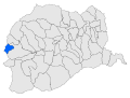 Localització de Cauders de Conflent respecte del Conflent.svg 428 × 323; 239 KB
-
 Map commune FR insee code 66047.png 756 × 605; 33 KB


