Category:Maps of Châtillon-sur-Cluses
Wikimedia category | |||||
| Upload media | |||||
| Instance of | |||||
|---|---|---|---|---|---|
| Category combines topics | |||||
| Châtillon-sur-Cluses | |||||
commune in Haute-Savoie, France    | |||||
| Instance of | |||||
| Named after | |||||
| Location |
| ||||
| Population |
| ||||
| Area |
| ||||
| official website | |||||
 | |||||
Subcategories
This category has only the following subcategory.
Media in category "Maps of Châtillon-sur-Cluses"
The following 10 files are in this category, out of 10 total.
-
 74064-Châtillon-sur-Cluses - Localisation.png 3,507 × 2,480; 1.27 MB
-
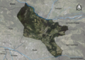
 74064-Châtillon-sur-Cluses-Cadastre.png 7,015 × 4,960; 14.32 MB
-
 74064-Châtillon-sur-Cluses-Hydro.jpeg 5,846 × 4,133; 2.51 MB
-
 74064-Châtillon-sur-Cluses-Hydro.png 7,015 × 4,960; 8.86 MB
-
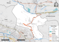
 74064-Châtillon-sur-Cluses-Natura 2000.png 7,015 × 4,960; 5.39 MB
-
 74064-Châtillon-sur-Cluses-Orthophoto.png 7,015 × 4,960; 10.59 MB
-
 74064-Châtillon-sur-Cluses-Sols.png 7,015 × 4,960; 9.25 MB
-
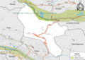
 74064-Châtillon-sur-Cluses-ZNIEFF1.png 7,015 × 4,960; 5.6 MB
-
 74064-Châtillon-sur-Cluses-ZNIEFF2.png 7,015 × 4,960; 5.61 MB
-
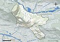
 Map commune FR insee code 74064.png 756 × 605; 53 KB


