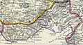
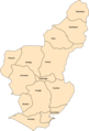
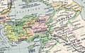
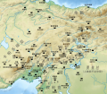
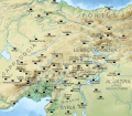
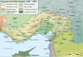
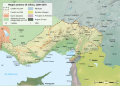
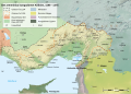
Category:Maps of Cilicia
Wikimedia category | |||||
| Upload media | |||||
| Instance of | |||||
|---|---|---|---|---|---|
| Category combines topics | |||||
| Cilicia | |||||
ancient region of Asia Minor  | |||||
| Instance of | |||||
| Named after |
| ||||
| Location | Anatolia | ||||
| Dissolved, abolished or demolished date |
| ||||
| Different from | |||||
 | |||||
Subcategories
This category has the following 6 subcategories, out of 6 total.
M
- Maps of the Eighth Crusade (3 F)
- Maps of the First Crusade (34 F)
- Maps of the Ninth Crusade (8 F)
- Maps of the Seventh Crusade (5 F)
- Maps of the Third Crusade (11 F)
P
- Ptolemy's 1st Asian Map (67 F)
Media in category "Maps of Cilicia"
The following 165 files are in this category, out of 165 total.
-
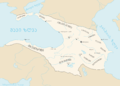
 Asia minor 1140.jpg 1,078 × 1,164; 566 KB
-
 Map Crusader states ca. 1100.jpg 454 × 1,114; 157 KB
-
 Mongol raids in Syria and Palestine 1260.svg 657 × 901; 316 KB
-
 1260MongolConquestsLevant.jpg 1,118 × 1,270; 121 KB
-
 1300FrancoMongolOffensiveLevant.jpg 1,864 × 2,128; 376 KB
-

-
-
 DAVIS(1879) p030 MAP OF ASIA MINOR, SHEWING THE DISTRICT VISITED BY DAVIS.jpg 2,395 × 1,597; 2.3 MB
-
 DAVIS(1879) p040 ROUTE MAP TO ILLUSTRATE DAVIS' JOURNEYS IN CILICIA.jpg 4,355 × 2,156; 4.56 MB
-
 6th-century Egypt-pt.svg 1,500 × 950; 3.15 MB
-
 6th-century Middle East-pt.svg 1,500 × 950; 3.13 MB
-
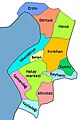
 Adana districts of Cilicia II.jpg 380 × 541; 49 KB
-
 Adana districts of Cilicia.png 640 × 944; 84 KB
-

-
 Anatolia 264.jpg 823 × 513; 191 KB
-
 Anatolian regions.png 625 × 379; 515 KB
-
 Antiochia sul Cidno.jpg 924 × 442; 93 KB
-
 Anville, Jean Baptiste Bourguignon. Turkey in Asia. 1794 (CC).jpg 1,240 × 544; 217 KB
-
 Arab-Byzantine frontier zone-ar.svg 1,705 × 1,498; 3.5 MB
-
 Arab-Byzantine frontier zone-es.svg 1,483 × 1,435; 11.67 MB
-
 Arab-Byzantine frontier zone-pt.svg 1,705 × 1,498; 2.41 MB
-
 Arab-Byzantine frontier zone-zh.svg 512 × 450; 2.55 MB
-
 Arab-Byzantine frontier zone.svg 1,705 × 1,498; 3.23 MB
-
 Armenianmeds.gif 699 × 471; 56 KB
-
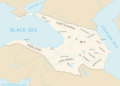
 Asia minor 1140-es.svg 932 × 1,008; 978 KB
-
 Asia Minor and the States of the Crusaders.jpg 1,200 × 1,282; 364 KB
-
 Asia Minor and the States of the Crusaders.svg 250 × 272; 651 KB
-
 Battle issus movements.png 738 × 563; 31 KB
-
 Bowen, Frances. Turkey in Asia. 1810 (N).jpg 1,157 × 697; 115 KB
-
 Campaign of the Battle of Ain Jalut 1260-ru.svg 432 × 572; 60 KB
-
 Carte Cilicie.png 483 × 444; 57 KB
-

-

-
 Cilicakingdomsa.jpg 405 × 277; 22 KB
-
 Cilicia (Imperium Romanum).png 2,495 × 1,775; 53 KB
-
 Cilicia Map by Heinrich Kiepert.png 640 × 311; 466 KB
-
 Cilicia-pt.svg 575 × 390; 3.15 MB
-
 Cilicia.png 800 × 386; 50 KB
-
 Cilician Armenia-ar.svg 2,508 × 1,789; 848 KB
-
 Cilician Armenia-cs.svg 2,508 × 1,789; 654 KB
-
 Cilician Armenia-en.svg 2,508 × 1,789; 713 KB
-
 Cilician Armenia-es.svg 1,458 × 991; 1,001 KB
-
 Cilician Armenia-fr.svg 1,458 × 991; 374 KB
-
 Cilician Armenia-hu.svg 2,508 × 1,789; 642 KB
-
 Cilician Armenia-hy.svg 2,508 × 1,789; 655 KB
-
 Cilician Armenia-it.svg 2,508 × 1,789; 671 KB
-
 Cilician Armenia-sv.svg 2,508 × 1,789; 671 KB
-
 Cilician Armenia. Reader.png 2,222 × 400; 939 KB
-
 Cilician Armenia.tif 900 × 616; 1.59 MB
-
 Cilician-Kingdom-pt.svg 1,500 × 950; 3.13 MB
-
 CiliciaPrincipadoDeAntioquíaYCondadoDeTrípoli.svg 955 × 1,315; 180 KB
-
 Crusade states in levant.PNG 291 × 504; 14 KB
-
 D385-Basse Cilicie.-L2-Ch9.png 1,452 × 1,550; 315 KB
-
 Darton, William. Turkey in Asia. 1811 (CC).jpg 1,892 × 784; 329 KB
-
 Donations of Alexandria 34BC.gif 761 × 490; 47 KB
-
 Ethnic Map Of Cilicia Eng.jpg 1,134 × 728; 488 KB
-
 Forteresses templières-es.svg 556 × 989; 231 KB
-
 Forteresses templières.png 552 × 986; 70 KB
-
 Forteresses templières.svg 556 × 989; 47 KB
-
 Georgian empire with tributaries-es.svg 889 × 639; 621 KB
-
 Georgian empire with tributaries-hy.png 1,976 × 1,419; 493 KB
-
 Georgian empire with tributaries.png 1,976 × 1,419; 413 KB
-
 Georgian empire-ka.png 1,974 × 1,418; 426 KB
-
 Georgian empire.png 1,974 × 1,418; 420 KB
-
 Hatay districts of Cilicia.jpg 302 × 452; 40 KB
-
 Heinrich Kiepert. Asia citerior.Cilicia.jpg 1,931 × 939; 438 KB
-
 Heinrich Kiepert. Imperia Persarum et Macedonum. 1903 (EB).jpg 1,323 × 817; 914 KB
-

-
 Karte Des Taurus und seiner Nebenzweige in den Paschaliken Adana und Marasch.jpg 7,042 × 9,204; 16.7 MB
-
 Killikiadana.gif 700 × 520; 52 KB
-
 Kingdom of Cilicia-Anatolia1200-Masry.jpg 508 × 413; 74 KB
-

-
 LatinEmpire2 (cropped).png 1,148 × 902; 1.27 MB
-
 LatinEmpire2-2.png 1,137 × 902; 995 KB
-
 LatinEmpire2-el.png 1,715 × 902; 1.59 MB
-
 LatinEmpire2-es.svg 2,759 × 1,532; 2.76 MB
-
 LatinEmpire2-pt.svg 512 × 210; 29 KB
-
 LatinEmpire2.png 1,715 × 902; 1.8 MB
-
 Le Tour du monde-03-p403.jpg 1,238 × 853; 306 KB
-
 Les districts de Zeitoun & d'Androun (1897).png 725 × 677; 476 KB
-
 Les environs de Zeitoun (1897).png 822 × 491; 394 KB
-
 LittleArmeniaPrincipality of AntiochTripoli-Arabic.jpg 530 × 600; 89 KB
-
 LittleArmeniaPrincipality of AntiochTripoli.jpg 530 × 600; 62 KB
-
 Lucas, Fielding Jr. Turkey in Asia. 1823 CD.jpg 893 × 424; 125 KB
-
 Mallo (Mallus).jpg 924 × 442; 92 KB
-
 Map Crusader states 1102-es.svg 591 × 690; 359 KB
-
 Map Crusader states 1102-fr.svg 591 × 690; 118 KB
-
 Map Crusader states 1102-hu.svg 591 × 690; 73 KB
-
 Map Crusader states 1102-it.svg 591 × 690; 716 KB
-
 Map Crusader states 1102-pt.svg 591 × 690; 42 KB
-
 Map Crusader states 1135-ar.png 649 × 882; 174 KB
-
 Map Crusader states 1135-de2.svg 690 × 738; 563 KB
-
 Map Crusader states 1135-el.svg 978 × 1,330; 490 KB
-
 Map Crusader states 1135-en.svg 955 × 1,315; 418 KB
-
 Map Crusader states 1135-eo.svg 978 × 1,330; 478 KB
-
 Map Crusader states 1135-es.svg 955 × 1,315; 428 KB
-
 Map Crusader states 1135-es2.svg 974 × 1,323; 293 KB
-
 Map Crusader states 1135-fr.svg 978 × 1,330; 582 KB
-
 Map Crusader states 1135-fr2.svg 744 × 921; 888 KB
-
 Map Crusader states 1135-hu.svg 955 × 1,315; 239 KB
-
 Map Crusader states 1135-it.png 978 × 1,330; 299 KB
-
 Map Crusader states 1135-jp.png 955 × 1,315; 301 KB
-
 Map Crusader states 1135-mk.svg 955 × 1,315; 394 KB
-
 Map Crusader states 1135-nl.svg 978 × 1,330; 654 KB
-
 Map Crusader states 1135-pl.png 1,631 × 2,217; 632 KB
-
 Map Crusader states 1135-pl.svg 978 × 1,330; 570 KB
-
 Map Crusader states 1135-pt.svg 974 × 1,323; 119 KB
-
 Map Crusader states 1148-fa.svg 978 × 1,330; 385 KB
-
 Map Crusader states 1165-en.svg 955 × 1,315; 362 KB
-
 Map Crusader states 1165-es.svg 955 × 1,315; 662 KB
-
 Map Crusader states 1165-fa.svg 955 × 1,315; 308 KB
-
 Map Crusader states 1165-it.svg 955 × 1,315; 129 KB
-
 Map Crusader states 1165-ka.png 955 × 1,315; 248 KB
-
 Map Crusader states 1165-pt.svg 955 × 1,315; 117 KB
-
 Map Crusader states 1190-ar.svg 978 × 1,330; 444 KB
-
 Map Crusader states 1190-arz.png 441 × 600; 68 KB
-
 Map Crusader states 1190-en.svg 978 × 1,330; 470 KB
-
 Map Crusader states 1190-es.svg 978 × 1,330; 185 KB
-
 Map Crusader states 1190-fa.svg 978 × 1,330; 323 KB
-
 Map Crusader states 1190-he.svg 978 × 1,330; 356 KB
-
 Map Crusader states 1190-it.png 978 × 1,330; 298 KB
-
 Map Crusader states 1190-it.svg 978 × 1,330; 591 KB
-
 Map Crusader states 1190-ka.png 978 × 1,330; 315 KB
-
 Map Crusader states 1190-pt.svg 978 × 1,330; 91 KB
-
 Map Crusader states 1190-ua.jpg 351 × 477; 159 KB
-
 Map Crusader states 1197-en.svg 507 × 690; 76 KB
-
 Map Crusader states 1197-es.svg 507 × 690; 114 KB
-
 Map Crusader states 1197-fr.svg 507 × 690; 596 KB
-
 Map Crusader states 1197-it.svg 507 × 690; 77 KB
-
 Map Crusader states 1197-ka.png 502 × 683; 104 KB
-
 Map Crusader states 1197-ru.svg 507 × 690; 76 KB
-
 Map Crusader states 1240-de.svg 507 × 690; 162 KB
-
 Map Crusader states 1240-eng.png 600 × 823; 110 KB
-
 Map Crusader states 1240-es.svg 507 × 690; 385 KB
-
 Map Crusader states 1240-fa.png 600 × 823; 117 KB
-
 Map Crusader states 1240-fr.svg 507 × 690; 636 KB
-
 Map Crusader states 1240-it.svg 507 × 690; 699 KB
-
 Map Crusader states 1240-pt.svg 507 × 690; 38 KB
-
 Map Crusader states ca. 1100-es.svg 545 × 1,337; 662 KB
-
 Map of Amanus.jpg 420 × 742; 319 KB
-
 Median Empire sr.svg 1,500 × 950; 1.78 MB
-
 Median Empire-ar.svg 1,500 × 950; 2.01 MB
-
 Median Empire-en.svg 1,500 × 950; 1.78 MB
-
 Median Empire-es.svg 1,500 × 950; 2.96 MB
-
 Median Empire-pt.svg 1,500 × 950; 3.13 MB
-
 Mersin districts of Cilicia.jpg 748 × 531; 70 KB
-
 Mongol raids in Syria and Palestine 1260-ar.svg 657 × 901; 318 KB
-
 Mongol raids in Syria and Palestine 1260-es.svg 657 × 901; 383 KB
-
 Mongol raids in Syria and Palestine 1260-he.svg 657 × 901; 272 KB
-
 Mongol raids in Syria and Palestine 1260-hu.svg 657 × 901; 210 KB
-
 Mongol raids in Syria and Palestine 1260-pt.svg 657 × 901; 173 KB
-
 Olbische Zeichen im Rauen Kilikien.jpg 8,452 × 6,416; 4.01 MB
-
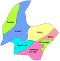 Osmaniye districts of Cilicia.png 533 × 539; 34 KB
-
 Osmaniye in Cilicia.jpg 284 × 222; 18 KB
-
 Partage de la Cilice entre l'Empire Séleucides et Ptolémaïque.jpg 1,174 × 850; 380 KB
-
 Pinkerton, John. Turkey in Asia. 1813 (GB).jpg 1,038 × 836; 359 KB
-
 Raids mongoli in Siria e Palestina-1260.it.svg 657 × 901; 434 KB
-
 Raues Kilikien zwischen Kalykadnos und Lamos.jpg 4,391 × 3,333; 2.69 MB
-
 REmpire-36 Cilicia.png 400 × 296; 27 KB
-
 Roman Empire - Cilicia (125 AD).svg 2,186 × 1,817; 629 KB
-
 Satrapie de Cilicie .jpg 727 × 570; 291 KB
-
 Sketch of the Cilician and Syrian Passes, 1838.jpg 469 × 604; 202 KB
-
 The Barony of Cilician Armenia, 1080-1199.gif 699 × 472; 47 KB
-
 The Crusader States in 1135-gl.svg 966 × 1,322; 220 KB
-
 Western Armenia and Cilicia.png 1,636 × 984; 56 KB


%27_(11248260265).jpg)
_p030_MAP_OF_ASIA_MINOR,_SHEWING_THE_DISTRICT_VISITED_BY_DAVIS.jpg)
_p040_ROUTE_MAP_TO_ILLUSTRATE_DAVIS%27_JOURNEYS_IN_CILICIA.jpg)


.jpg)


.jpg)


.jpg)


.png)


.jpg)


.jpg)
_(14591471457).jpg)


.png)


.png)
.png)


.jpg)


.jpg)


.svg)


._Turkey_in_Asia,_Transcaucasia._1861_(DD).jpg)