Category:Maps of Clay County, Minnesota
Counties of Minnesota: Aitkin · Anoka · Becker · Beltrami · Benton · Big Stone · Blue Earth · Brown · Carlton · Carver · Cass · Chippewa · Chisago · Clay · Clearwater · Cook · Cottonwood · Crow Wing · Dakota · Dodge · Douglas · Faribault · Fillmore · Freeborn · Goodhue · Grant · Hennepin · Houston · Hubbard · Isanti · Itasca · Jackson · Kanabec · Kandiyohi · Kittson · Koochiching · Lac qui Parle · Lake · Lake of the Woods · Le Sueur · Lincoln · Lyon · Mahnomen · Marshall · Martin · McLeod · Meeker · Mille Lacs · Morrison · Mower · Murray · Nicollet · Nobles · Norman · Olmsted · Otter Tail · Pennington · Pine · Pipestone · Polk · Pope · Ramsey · Red Lake · Redwood · Renville · Rice · Rock · Roseau · St. Louis · Scott · Sherburne · Sibley · Stearns · Steele · Stevens · Swift · Todd · Traverse · Wabasha · Wadena · Waseca · Washington · Watonwan · Wilkin · Winona · Wright · Yellow Medicine
Wikimedia category | |||||
| Upload media | |||||
| Instance of | |||||
|---|---|---|---|---|---|
| Category combines topics | |||||
| Clay County | |||||
county in Minnesota, United States   | |||||
| Instance of | |||||
| Named after | |||||
| Location | Minnesota | ||||
| Capital | |||||
| Inception |
| ||||
| Population |
| ||||
| Area |
| ||||
| Different from | |||||
| official website | |||||
 | |||||
Media in category "Maps of Clay County, Minnesota"
The following 24 files are in this category, out of 24 total.
-

-
-

-

-
-

-

-

-

-
-

-

-
 Map of Minnesota highlighting Clay County.svg 1,045 × 1,189; 67 KB
-
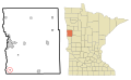
 MNMap-doton-Barnesville.png 262 × 300; 10 KB
-
 MNMap-doton-Comstock.png 262 × 300; 10 KB
-
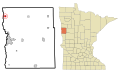
 MNMap-doton-Dilworth.png 262 × 300; 10 KB
-
 MNMap-doton-Felton.png 262 × 300; 10 KB
-
 MNMap-doton-Georgetown.png 262 × 300; 10 KB
-
 MNMap-doton-Glyndon.png 262 × 300; 10 KB
-
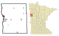
 MNMap-doton-Hawley.png 262 × 300; 10 KB
-
 MNMap-doton-Hitterdal.png 262 × 300; 10 KB
-
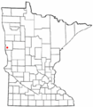
 MNMap-doton-Moorhead.png 262 × 300; 10 KB
-
 MNMap-doton-Sabin.png 262 × 300; 10 KB
-
 MNMap-doton-Ulen.png 262 × 300; 10 KB


