Category:Maps of Corgoloin
Wikimedia category | |||||
| Upload media | |||||
| Instance of | |||||
|---|---|---|---|---|---|
| Category combines topics | |||||
| Corgoloin | |||||
commune in Côte-d'Or, France  .svg)  | |||||
| Instance of | |||||
| Location | |||||
| Population |
| ||||
| Area |
| ||||
| official website | |||||
 | |||||
Media in category "Maps of Corgoloin"
The following 4 files are in this category, out of 4 total.
-
 21194-Corgoloin-Hydro.jpeg 5,846 × 4,133; 1.74 MB
-
 21194-Corgoloin-Sols.png 3,270 × 2,598; 1.74 MB
-
 Manoir de Moux (Géoportail).jpg 731 × 572; 214 KB
-
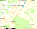 Map commune FR insee code 21194.png 756 × 605; 52 KB


.jpg)