Category:Maps of Courçay
Wikimedia category | |||||
| Upload media | |||||
| Instance of | |||||
|---|---|---|---|---|---|
| Category combines topics | |||||
| Courçay | |||||
commune in Indre-et-Loire, France  .svg)  | |||||
| Pronunciation audio | |||||
| Instance of | |||||
| Location |
| ||||
| Located in or next to body of water | |||||
| Street address |
| ||||
| Population |
| ||||
| Area |
| ||||
| official website | |||||
 | |||||
Media in category "Maps of Courçay"
The following 16 files are in this category, out of 16 total.
-
 37085-Courçay-argile.png 3,057 × 2,480; 2.86 MB
-
 37085-Courçay-Cours eau.jpg 3,507 × 2,480; 712 KB
-
 37085-Courçay-Hydro.jpeg 5,846 × 4,133; 2.21 MB
-
 37085-Courçay-Sols.png 3,270 × 2,598; 3.01 MB
-
 Cormery Cassini.jpg 648 × 473; 73 KB
-
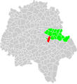 Courçay canton.svg 1,000 × 1,091; 133 KB
-
 Courçay Cassini.jpg 513 × 509; 80 KB
-
 Courçay moulins.svg 967 × 603; 153 KB
-
 Courçay OSM.jpg 327 × 382; 37 KB
-
 Courçay patrimoine naturel.svg 796 × 505; 25 KB
-
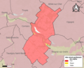
 Courçay urbanisme.svg 703 × 474; 29 KB
-
 Map commune FR insee code 37085.png 756 × 605; 82 KB
-
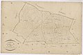
 Plan cadastral Courçay 01.jpg 240 × 156; 10 KB
-
 Plan cadastral Courçay 02.jpg 256 × 170; 15 KB
-
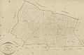
 Plan cadastral Courçay.jpg 746 × 505; 52 KB
-
 Plan cadastral Courçay2.jpg 738 × 481; 50 KB


