Category:Maps of Crempigny-Bonneguête
Wikimedia category | |||||
| Upload media | |||||
| Instance of | |||||
|---|---|---|---|---|---|
| Category combines topics | |||||
| Crempigny-Bonneguête | |||||
commune in Haute-Savoie, France    | |||||
| Instance of |
| ||||
| Location |
| ||||
| Inception |
| ||||
| Population |
| ||||
| Area |
| ||||
| Replaces |
| ||||
| official website | |||||
 | |||||
Subcategories
This category has only the following subcategory.
Media in category "Maps of Crempigny-Bonneguête"
The following 10 files are in this category, out of 10 total.
-
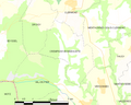
 74095-Crempigny-Bonneguête - Localisation.png 3,507 × 2,480; 1.27 MB
-
 74095-Crempigny-Bonneguête-Cadastre.png 7,015 × 4,960; 6.51 MB
-
 74095-Crempigny-Bonneguête-Hydro.jpeg 5,846 × 4,133; 1.42 MB
-
 74095-Crempigny-Bonneguête-Hydro.png 7,015 × 4,960; 3.23 MB
-
 74095-Crempigny-Bonneguête-Natura 2000.png 7,015 × 4,960; 2.66 MB
-
 74095-Crempigny-Bonneguête-Orthophoto.png 7,015 × 4,960; 7.34 MB
-
 74095-Crempigny-Bonneguête-Sols.png 7,015 × 4,960; 3.56 MB
-
 74095-Crempigny-Bonneguête-ZNIEFF1.png 7,015 × 4,960; 2.85 MB
-
 74095-Crempigny-Bonneguête-ZNIEFF2.png 7,015 × 4,960; 2.83 MB
-
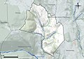
 Map commune FR insee code 74095.png 756 × 605; 42 KB


