Category:Maps of De Ronde Venen
Wikimedia category | |||||
| Upload media | |||||
| Instance of | |||||
|---|---|---|---|---|---|
| Category combines topics | |||||
| De Ronde Venen | |||||
municipality in the Netherlands    .svg) | |||||
| Instance of |
| ||||
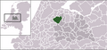
| Location | Utrecht, Netherlands | ||||
| Located in or next to body of water | |||||
| Head of government |
| ||||
| Inception |
| ||||
| Population |
| ||||
| Area |
| ||||
| Elevation above sea level |
| ||||
| Replaces | |||||
| official website | |||||
 | |||||
Subcategories
This category has the following 2 subcategories, out of 2 total.
A
L
Media in category "Maps of De Ronde Venen"
The following 21 files are in this category, out of 21 total.
-
 Map - NL - Municipality code 0736 (2009).svg 300 × 160; 530 KB
-
 2013-DeRondeVenen.jpg 2,912 × 2,874; 6 MB
-
 BAG woonplaatsen - Gemeente De Ronde Venen.png 2,419 × 2,419; 865 KB
-
 De Ronde Venen 1665.JPG 860 × 593; 139 KB
-
 Dutch Municipality De Ronde Venen 2006.png 280 × 130; 9 KB
-
 Dutch Municipality De Ronde Venen 2012.png 280 × 130; 9 KB
-
 FMIB 43958 Zuyder Polder.jpeg 895 × 1,016; 417 KB
-
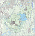 Gem-DeRondeVenen-2014Q1.jpg 5,557 × 5,692; 16.66 MB
-
 Gem-DeRondeVenen-OpenTopo.jpg 6,814 × 6,897; 8.51 MB
-
 Hoekwater polderkaart - Groot Mijdrecht.PNG 535 × 523; 606 KB
-
 Hoekwater polderkaart - Polders bij Baambrugge.PNG 431 × 455; 501 KB
-
 LocatieDeRondeVenen.png 270 × 130; 9 KB
-
 Map - NL - De Ronde Venen (2009).svg 625 × 575; 3.48 MB
-
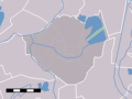
 Map - NL - Municipality code 0736 (2014).png 2,000 × 1,067; 193 KB
-
 Map - NL - Municipality code 0736 (2019).svg 300 × 160; 444 KB
-
 Map NL - De Ronde Venen - Amstelhoek.png 800 × 600; 12 KB
-
 Map NL - De Ronde Venen - Baambrugse Zuwe.png 800 × 600; 13 KB
-
 Map NL - De Ronde Venen - Groenlandsekade en Vinkekade.png 800 × 600; 12 KB
-
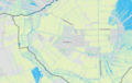 Map NL - De Ronde Venen - Mijdrecht.png 990 × 624; 651 KB
-
 Map NL - De Ronde Venen - Vinkeveen.png 800 × 600; 9 KB
-
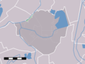
 NL - locator map municipality code GM0736 (2016).png 2,125 × 1,417; 490 KB


.svg)
.png)
.svg)


.png)