Category:Maps of Dions
Wikimedia category | |||||
| Upload media | |||||
| Instance of | |||||
|---|---|---|---|---|---|
| Category combines topics | |||||
| Dions | |||||
commune in Gard, France ,_%C3%A9glise_de_Vic.JPG) .svg)  | |||||
| Instance of | |||||
| Location |
| ||||
| Population |
| ||||
| Area |
| ||||
| Elevation above sea level |
| ||||
| official website | |||||
 | |||||
Media in category "Maps of Dions"
The following 7 files are in this category, out of 7 total.
-
 30102-Dions-argile.png 3,057 × 2,480; 3.28 MB
-
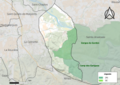 30102-Dions-Natura2000.png 5,846 × 4,133; 9.12 MB
-
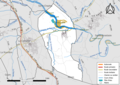 30102-Dions-Routes-Hydro.png 3,507 × 2,480; 2.21 MB
-
 30102-Dions-Sols.png 3,270 × 2,598; 2.21 MB
-
 30102-Dions-ZNIEFF1.png 3,057 × 2,480; 4.06 MB
-
 30102-Dions-ZNIEFF2.png 3,519 × 2,480; 4.3 MB
-
 Map commune FR insee code 30102.png 756 × 605; 48 KB


