Category:Maps of Durfort (Ariège)
Wikimedia category | |||||
| Upload media | |||||
| Instance of | |||||
|---|---|---|---|---|---|
| Category combines topics | |||||
| Durfort | |||||
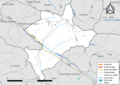
commune in Ariège, France _OSM_03.png) | |||||
| Instance of | |||||
| Location |
| ||||
| Population |
| ||||
| Area |
| ||||
| Elevation above sea level |
| ||||
| Different from | |||||
 | |||||
Media in category "Maps of Durfort (Ariège)"
The following 10 files are in this category, out of 10 total.
-
 09109-Durfort-argile.png 4,076 × 3,307; 5.32 MB
-
 09109-Durfort-Natura2000.png 7,015 × 4,960; 8.17 MB
-
 09109-Durfort-Natura2000b.png 5,846 × 4,133; 9.64 MB
-
 09109-Durfort-Routes-Hydro.png 3,507 × 2,480; 1.6 MB
-
 09109-Durfort-ZNIEFF1.png 3,519 × 2,480; 5.7 MB
-
 09109-Durfort-ZNIEFF2.png 3,519 × 2,480; 5.67 MB
-
 Durfort (Ariège) OSM 01.png 1,076 × 1,158; 990 KB
-
 Durfort (Ariège) OSM 02.png 1,076 × 1,158; 2.54 MB
-
 Durfort (Ariège) OSM 03.png 972 × 976; 1.41 MB
-
 Map commune FR insee code 09109.png 756 × 605; 37 KB


_OSM_01.png)
_OSM_02.png)
