Category:Maps of East Africa
Wikimedia category  | |||||
| Upload media | |||||
| Instance of | |||||
|---|---|---|---|---|---|
| Category combines topics | |||||
| East Africa | |||||
easterly region of the African continent .svg) | |||||
| Instance of | |||||
| Part of | |||||
| Location | Africa, Southern Hemisphere | ||||
| Has part(s) | |||||
 | |||||
English: Super-national maps of East Africa. Please sort more detailed maps (within one single country, or border maps between two) into "Maps of..." the respective countries.
Subcategories
This category has the following 24 subcategories, out of 24 total.
+
-
B
C
D
E
K
M
R
S
T
U
Z
Media in category "Maps of East Africa"
The following 37 files are in this category, out of 37 total.
-

-
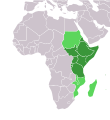
 East-Africa.svg 1,200 × 1,230; 55 KB
-
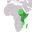
 East Africa (UN subregion).svg 1,000 × 1,000; 143 KB
-
 Africa (Eastern region).png 341 × 341; 10 KB
-
 Africa-countries-eastern.png 360 × 392; 10 KB
-
 Africa-countries-eastern.svg 384 × 420; 26 KB
-
 Africa-countries-northeast.svg 384 × 420; 26 KB
-
 Afryka Wschodnia.png 360 × 392; 24 KB
-
 CECAFA-Map.svg 550 × 550; 158 KB
-
 EAF.png 350 × 350; 11 KB
-
 East Africa drought 2006 NASA.jpg 540 × 884; 192 KB
-
 East African Lakes - Bishop Lechaptois.svg 240 × 469; 93 KB
-
 Eastern-Africa-map.PNG 360 × 392; 10 KB
-
 Eastern-Africa-map.svg 1,000 × 1,000; 274 KB
-
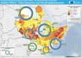
 ECDM 20170328 East Africa Famine v4.pdf 1,754 × 1,239; 534 KB
-
 ECDM 20180622 DailyMap Eastern Africa FoodInsec Displacupdated.pdf 1,754 × 1,239; 753 KB
-
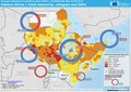 ECDM 20190405 Eastern Africa.pdf 1,754 × 1,239; 752 KB
-
 Enhydriodon East Africa.png 990 × 439; 923 KB
-
 Greater Northeast Africa.png 379 × 392; 10 KB
-
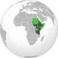
 Horn of Africa.png 1,000 × 1,000; 230 KB
-
 Igad2.png 997 × 996; 237 KB
-
 Koppen-Geiger Map Eastern Africa future.svg 1,329 × 850; 2.17 MB
-
 Koppen-Geiger Map Eastern Africa present.svg 1,329 × 850; 2.46 MB
-
 LocationEasternAfrica.png 359 × 359; 8 KB
-
 Locust Infestation Food Security Map 2020.png 2,160 × 1,446; 270 KB
-
 MAP Eastern Africa coastal forests.png 408 × 536; 47 KB
-
 Map of Countries in East Africa.svg 1,000 × 1,000; 190 KB
-
 Map of East African countries.svg 512 × 516; 237 KB
-
 Ostafrikaneu-HE.jpg 587 × 882; 44 KB
-
 Ostafrikaneu.jpg 695 × 949; 71 KB
-
 Pays Afrique Est.png 360 × 392; 13 KB
-
 Political map of East Africa according UN mk.svg 1,200 × 1,230; 64 KB
-
 Political map of East Africa mk.svg 1,200 × 1,230; 61 KB
-
 UN Macroregion Eastern Africa.svg 1,000 × 1,000; 171 KB
-
 Östafrika landsnamn.png 2,169 × 2,049; 989 KB
-
 Östafrika landsnamn.svg 1,525 × 1,440; 1.23 MB
-
 Östafrika.png 997 × 996; 134 KB

.png)


