Category:Maps of Err
Wikimedia category | |||||
| Upload media | |||||
| Instance of | |||||
|---|---|---|---|---|---|
| Category combines topics | |||||
| Err | |||||
commune in Pyrénées-Orientales, France .JPG) Les dues esglésies d'Er  | |||||
| Pronunciation audio | |||||
| Instance of | |||||
| Location | |||||
| Head of government |
| ||||
| Population |
| ||||
| Area |
| ||||
| Elevation above sea level |
| ||||
 | |||||
Media in category "Maps of Err"
The following 2 files are in this category, out of 2 total.
-
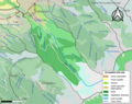 66067-Err-Sols.png 3,270 × 2,598; 2.12 MB
-
 Map commune FR insee code 66067.png 756 × 605; 71 KB
