Category:Maps of Fondettes
Wikimedia category | |||||
| Upload media | |||||
| Instance of | |||||
|---|---|---|---|---|---|
| Category combines topics | |||||
| Fondettes | |||||
commune in Indre-et-Loire, France  .svg)  | |||||
| Pronunciation audio | |||||
| Instance of | |||||
| Location |
| ||||
| Located in or next to body of water | |||||
| Population |
| ||||
| Area |
| ||||
| Elevation above sea level |
| ||||
| official website | |||||
 | |||||
Subcategories
This category has only the following subcategory.
G
- Geological maps of Fondettes (3 F)
Media in category "Maps of Fondettes"
The following 36 files are in this category, out of 36 total.
-
 37109-Fondettes-argile.png 3,057 × 2,480; 4.27 MB
-
 37109-Fondettes-Cours eau.jpg 3,507 × 2,480; 777 KB
-
 37109-Fondettes-Hydro.jpeg 5,846 × 4,133; 3.25 MB
-
 37109-Fondettes-Sols.png 3,270 × 2,598; 4.82 MB
-
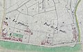
 Carte des bords de Loire - détails port Fondettes.jpg 690 × 505; 144 KB
-
 Carte levées aménagements Loire - Fondettes.jpg 644 × 385; 82 KB
-
 Carte ports de Fondettes sur la Loire.jpg 700 × 411; 148 KB
-
-
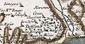
 Extrait carte Cassini Fondettes et limites communales.jpg 1,222 × 604; 221 KB
-
 Fondettes géolocalisation 02.jpg 851 × 520; 96 KB
-
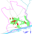
 Fondettes patrimoine.svg 496 × 524; 43 KB
-
 Fondettes sites.svg 496 × 524; 42 KB
-
 Fondettes sur carte de Cassini.jpg 1,249 × 634; 151 KB
-
 Fondettes urbanisme.svg 496 × 524; 45 KB
-
 Géolocalisation de Vallières 01.jpg 356 × 336; 44 KB
-
 Géolocalisation de Vallières 02.jpg 89 × 84; 3 KB
-
 Géolocalisation du prieuré de Lavaré (ou Lavaray) à Fondettes.jpg 861 × 460; 28 KB
-
 Localisation de la chapelle de la Chevalette.jpg 1,227 × 645; 62 KB
-
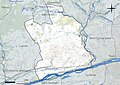
 Localisation et limites communales de Fondettes.jpg 718 × 668; 155 KB
-
 Manoir des Hamardières localisation.jpg 254 × 240; 18 KB
-
 Manoir du Thouadé géolocalisation.jpg 1,227 × 645; 58 KB
-
 Map commune FR insee code 37109.png 756 × 605; 98 KB
-
 Plan cadastrale napooléonien commune Fondettes 01.jpg 6,659 × 4,002; 1.43 MB
-
 Plan cadastrale napooléonien commune Fondettes 02.jpg 713 × 510; 47 KB
-
 Plan de Fondettes et du château de la Plaine 1940.jpg 221 × 190; 16 KB
-
 Site de Beaumanoir Montboyau 01.jpg 718 × 678; 111 KB
-
 Site de Châtigny.jpg 717 × 678; 38 KB
-
 Site de la Chevallette 01.jpg 877 × 440; 77 KB
-
 Site de la Chevallette Pivotières Vallières et la Plaine.jpg 871 × 446; 77 KB
-
 Site de La Plaine 03.jpg 576 × 405; 46 KB
-
 Site de La Plaine.jpg 850 × 439; 71 KB
-
 Site de Lavaray.jpg 127 × 120; 3 KB
-
 Site de Saint-Symphorien.jpg 717 × 678; 86 KB
-
 Site des Hamardières.jpg 63 × 60; 2 KB
-
 Site du manoir des Hamarières.jpg 1,228 × 645; 53 KB
-
 Site du Thouadé.jpg 717 × 678; 39 KB


_%C3%A0_Fondettes.jpg)


