Category:Maps of Fresnay-sur-Sarthe
Wikimedia category | |||||
| Upload media | |||||
| Instance of | |||||
|---|---|---|---|---|---|
| Category combines topics | |||||
| Fresnay-sur-Sarthe | |||||
commune in Sarthe, France  .svg) | |||||
| Instance of |
| ||||
| Location |
| ||||
| Located in or next to body of water | |||||
| Legal form |
| ||||
| Inception |
| ||||
| Population |
| ||||
| Area |
| ||||
| Replaces | |||||
| official website | |||||
 | |||||
Media in category "Maps of Fresnay-sur-Sarthe"
The following 2 files are in this category, out of 2 total.
-
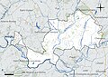 72138-Fresnay-sur-Sarthe-Hydro.jpeg 5,846 × 4,133; 2.43 MB
-
 72138-Fresnay-sur-Sarthe-Sols.png 3,270 × 2,598; 3.36 MB

