Category:Maps of Genneton
Wikimedia category | |||||
| Upload media | |||||
| Instance of | |||||
|---|---|---|---|---|---|
| Category combines topics | |||||
| Genneton | |||||
commune in Deux-Sèvres, France   | |||||
| Instance of | |||||
| Location |
| ||||
| Population |
| ||||
| Area |
| ||||
 | |||||
Media in category "Maps of Genneton"
The following 6 files are in this category, out of 6 total.
-
 79132-Genneton-argile.jpg 3,057 × 2,480; 588 KB
-
 79132-Genneton-Hydro.png 3,507 × 2,480; 4.11 MB
-
 79132-Genneton-Sols.png 3,270 × 2,598; 2.07 MB
-
 79132-Genneton-ZNIEFF1.png 5,866 × 4,133; 7.31 MB
-
 79132-Genneton-ZNIEFF2.png 5,866 × 4,133; 7.07 MB
-
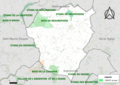
 Map commune FR insee code 79132.png 756 × 605; 52 KB


