Category:Maps of Germany during World War II
Countries of Europe: Albania · Belarus · Belgium · Bosnia and Herzegovina · Bulgaria · France‡ · Germany · Hungary · Latvia · Lithuania · Luxembourg · Montenegro · Netherlands‡ · Poland · Serbia
Media in category "Maps of Germany during World War II"
The following 57 files are in this category, out of 57 total.
-
 17MAR45Map001.JPG 800 × 461; 123 KB
-
 2009-11-22-seelower-hoehen-by-Ralf-68-V2.jpg 2,445 × 1,757; 1.69 MB
-
 2009-11-22-seelower-hoehen-by-Ralf-68.jpg 2,518 × 1,750; 2.24 MB
-
 65. US-Infanterie-Division April 1945 - Neumarkt.jpg 480 × 660; 85 KB
-
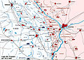
 Advance through Germany - 5-18 April 1945.jpg 1,261 × 956; 1.96 MB
-
 Allemagne 45.jpg 1,701 × 2,338; 647 KB
-
 Allemagne 45.png 1,701 × 2,338; 812 KB
-
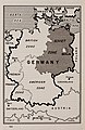 Allied Occupation Zones of Germany after WW II.jpg 2,159 × 3,318; 1.82 MB
-
 Areas annexed by Nazi Germany.png 1,111 × 745; 154 KB
-
 Battle for Reichstag 1945 map-rus.png 1,012 × 1,463; 1.98 MB
-
 Battle of Berlin 1945-a esp.jpg 2,601 × 2,352; 1.56 MB
-
 Battle of Berlin 1945-bj-HU.png 1,024 × 928; 448 KB
-
 Battle of Seelow Heights (el).png 3,000 × 1,816; 1.01 MB
-
 Berlin 1945.png 3,042 × 1,970; 1.26 MB
-
 Battle for Reichstag 1945 map-eng.png 1,012 × 1,463; 1.97 MB
-
 Battle for Reichstag 1945 map-hun.png 1,012 × 1,463; 2.21 MB
-
 BleialfMap 429.jpg 1,986 × 1,218; 273 KB
-
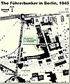 FuehrerBunkerBerlinLocation.jpg 700 × 830; 532 KB
-

-
 Chart 4 radio intelligence operation findings during French Campaign.svg 931 × 702; 206 KB
-

-
-
 Chart 9 German Radio Intelligence Operations in Southern Russia 1941-42.svg 1,076 × 695; 505 KB
-
 Dresden Luftangriffe.png 1,079 × 935; 276 KB
-
 France map Lambert-93 with regions and departments-occupation evolution.PNG 1,896 × 601; 1.43 MB
-
 GERMAN OPERATIONS AND PLANS.png 2,940 × 2,317; 845 KB
-
 German-occupied Europe.svg 450 × 456; 545 KB
-
 Grossdeutsches Reich NS Administration 1944.png 2,615 × 2,030; 250 KB
-
 Kanal hohenzollernow 1945.png 2,580 × 2,088; 2.24 MB
-
 Karte Rollwald.png 1,884 × 1,189; 80 KB
-
 Karte westwall.png 800 × 1,391; 161 KB
-
 La carte de l'assaut du Reichstag.png 1,012 × 1,463; 1.99 MB
-
 La tarjeta del asalto del Reichstag.png 1,012 × 1,463; 2.08 MB
-
 Lenino 1943 en.png 2,135 × 2,559; 1.6 MB
-
 Lenino 1943.png 2,138 × 2,500; 1.53 MB
-
 Location map of Gau Westmark.svg 1,038 × 767; 514 KB
-
 Map flag of Nazi Germany in 1942.png 1,133 × 1,162; 302 KB
-

-
-
 Military Administration in the Soviet Union (1942).svg 203 × 177; 670 KB
-
 Nazi Germany Flag Map in 1942.png 1,088 × 998; 107 KB
-
 Nazi Germany Flag map(1942).png 3,464 × 1,948; 551 KB
-
 Ofensiva del Saar2.jpg 1,041 × 764; 227 KB
-
 Operacja berlin 1 1945.png 2,601 × 2,352; 1.73 MB
-
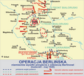 Operacja berlin 2 1945.png 2,600 × 2,355; 1.7 MB
-
-
-
-
-

-
-
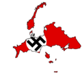
 Planned partition of Asia.png 599 × 329; 13 KB
-
-
 Schlacht um Berlin.png 2,601 × 2,352; 1.74 MB
-
 Verlegung OKW (1945).jpg 909 × 1,471; 636 KB
-
 WWII - The War of Lines (RU).svg 756 × 800; 2.82 MB
-
 Übersichtskarte der Bunkerbaustelle Mettenheim Ampfing.JPG 482 × 664; 83 KB


.png)


_(Bundesarchiv_Koblenz_R_43_II_1404_a_0197).jpg)
_(Bundesarchiv_Koblenz_R_43_II_1404_a_0199).jpg)
.svg)

.png)


.jpg)
.svg)
