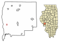
Category:Maps of Greene County, Illinois
Counties of Illinois: Adams · Alexander · Bond · Boone · Brown · Bureau · Calhoun · Carroll · Cass · Champaign · Christian · Clark · Clay · Clinton · Coles · Cook · Crawford · Cumberland · DeKalb · DeWitt · Douglas · DuPage · Edgar · Edwards · Effingham · Fayette · Ford · Franklin · Fulton · Gallatin · Greene · Grundy · Hamilton · Hancock · Hardin · Henderson · Henry · Iroquois · Jackson · Jasper · Jefferson · Jersey · Jo Daviess · Johnson · Kane · Kankakee · Kendall · Knox · Lake · LaSalle · Lawrence · Lee · Livingston · Logan · Macon · Macoupin · Madison · Marion · Marshall · Mason · Massac · McDonough · McHenry · McLean · Menard · Mercer · Monroe · Montgomery · Morgan · Moultrie · Ogle · Peoria · Perry · Piatt · Pike · Pope · Pulaski · Putnam · Randolph · Richland · Rock Island · St. Clair · Saline · Sangamon · Schuyler · Scott · Shelby · Stark · Stephenson · Tazewell · Union · Vermilion · Wabash · Warren · Washington · Wayne · White · Whiteside · Will · Williamson · Winnebago · Woodford
Wikimedia category | |||||
| Upload media | |||||
| Instance of | |||||
|---|---|---|---|---|---|
| Category combines topics | |||||
| Greene County | |||||
county in Illinois, United States   | |||||
| Instance of | |||||
| Named after | |||||
| Location | Illinois | ||||
| Capital | |||||
| Inception |
| ||||
| Population |
| ||||
| Area |
| ||||
| Different from | |||||
| official website | |||||
 | |||||
Media in category "Maps of Greene County, Illinois"
The following 39 files are in this category, out of 39 total.
-
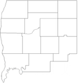 Greene County Blank.PNG 545 × 586; 16 KB
-
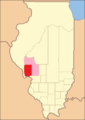 Greene County Illinois 1821.png 288 × 405; 8 KB
-
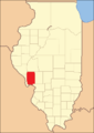
 Greene County Illinois 1823.png 288 × 405; 8 KB
-
 Greene County Illinois 1825.png 288 × 405; 9 KB
-
 Greene County Illinois 1829.png 288 × 405; 9 KB
-
 Greene County Illinois 1839.png 288 × 405; 10 KB
-

-

-
-
-

-

-

-

-

-

-

-

-

-

-

-

-

-

-
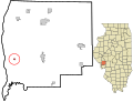
 Greene County Illinois incorporated and unincorporated areas.svg 835 × 639; 3.57 MB
-
 Map highlighting Athensville Township, Greene County, Illinois.svg 512 × 512; 38 KB
-
 Map highlighting Bluffdale Township, Greene County, Illinois.svg 512 × 512; 47 KB
-
 Map highlighting Carrollton Township, Greene County, Illinois.svg 512 × 512; 58 KB
-
 Map highlighting Kane Township, Greene County, Illinois.svg 512 × 512; 65 KB
-
 Map highlighting Linder Township, Greene County, Illinois.svg 512 × 512; 73 KB
-
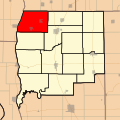 Map highlighting Patterson Township, Greene County, Illinois.svg 512 × 512; 83 KB
-
 Map highlighting Rockbridge Township, Greene County, Illinois.svg 512 × 512; 93 KB
-
 Map highlighting Roodhouse Township, Greene County, Illinois.svg 512 × 512; 100 KB
-
 Map highlighting Rubicon Township, Greene County, Illinois.svg 512 × 512; 110 KB
-
 Map highlighting Walkerville Township, Greene County, Illinois.svg 512 × 512; 119 KB
-
 Map highlighting White Hall Township, Greene County, Illinois.svg 512 × 512; 132 KB
-
 Map highlighting Woodville Township, Greene County, Illinois.svg 512 × 512; 161 KB
-
 Map highlighting Wrights Township, Greene County, Illinois.svg 512 × 512; 143 KB
-
 Map of Illinois highlighting Greene County.svg 3,453 × 6,157; 85 KB


