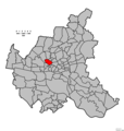
Category:Maps of Hamburg-Eimsbüttel
Wikimedia category | |||||
| Upload media | |||||
| Instance of | |||||
|---|---|---|---|---|---|
| Category combines topics | |||||
| Eimsbüttel | |||||
quarter in the Eimsbüttel borough of Hamburg, Germany  U-Bahnhof Schlump  | |||||
| Instance of | |||||
| Location | Eimsbüttel, Hamburg, Germany | ||||
| Population |
| ||||
| Area |
| ||||
| Different from | |||||
 | |||||
Media in category "Maps of Hamburg-Eimsbüttel"
The following 28 files are in this category, out of 28 total.
-
 Eimsbüttel in HH.svg 1,713 × 1,689; 780 KB
-
 Pincerno - Eimsbüttel - 11-2008.PNG 1,267 × 1,333; 48 KB
-
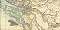
 Varendorf(62)Altona Hamburg Harburg.jpg 3,565 × 3,602; 15.77 MB
-
 Hamburg 1790 Elbinseln Varendorf.jpg 3,785 × 2,836; 9.89 MB
-
 Hamburg 1790 große karte varendorf.jpg 7,040 × 3,530; 24.56 MB
-
 Karte hamburg 1790 varendorf kl.jpg 2,000 × 1,003; 1.28 MB
-
 Schulterblatt um 1790.jpg 646 × 605; 531 KB
-
 Map hamburg 1800.png 854 × 792; 390 KB
-
 Pincerno - Niederelbe 1860.jpg 1,191 × 842; 315 KB
-
 Hamburg1880Gaedechens.jpeg 8,342 × 6,339; 13.81 MB
-
 Schanzenviertel gaedechens 1600-2.png 452 × 575; 436 KB
-
 1890 - Norddeutsche Staaten.jpg 3,170 × 1,825; 5.73 MB
-
 Brockhaus and Efron Encyclopedic Dictionary b84 499-0.jpg 3,350 × 2,806; 2.92 MB
-
 Hamburg 1898 Meyers 5. Aufl..jpg 3,176 × 2,480; 7.3 MB
-
 Meyers b8 s0038a.jpg 3,184 × 2,490; 7.07 MB
-
 Hamburg 1905 Meyers 6. Aufl..jpg 3,193 × 2,479; 7.88 MB
-
 Map hamburg altona 1910.jpg 2,605 × 1,980; 1.62 MB
-
 Schulterblatt schanzenviertel 1910.jpg 630 × 583; 524 KB
-
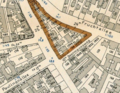 Doormannsweg in Bebauungsplan für den Stadtteil Eimsbüttel (1904).png 933 × 722; 1.32 MB
-
 Fruchtallee in Bebauungsplan für den Stadtteil Eimsbüttel (1904).png 1,896 × 852; 3.81 MB
-
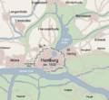
 HH-Eimsbüttel-quarter.jpg 843 × 746; 388 KB
-
 PPN611970430 Karte der Vogtei Eimsbüttel (1867).jpg 8,289 × 6,399; 7.62 MB
-
 PPN748795936 Bebauungsplan für den Stadtteil Eimsbüttel (1904).jpg 6,491 × 5,197; 5.92 MB
-
 PPN748795936 Bebauungsplan für den Stadtteil Eimsbüttel (1904).tif 6,668 × 5,567; 14.42 MB
-
 PPN748796266 Bebauungsplan für den Stadtteil Eimsbüttel (1904).jpg 6,526 × 5,199; 5.25 MB
-
 PPN748796266 Bebauungsplan für den Stadtteil Eimsbüttel (1904).tif 6,733 × 5,614; 11.83 MB
-
 Hamburg Wahlkreis 5.png 1,186 × 1,144; 28 KB
-
 Hamburg Wahlkreis 6.png 1,186 × 1,144; 28 KB

Altona_Hamburg_Harburg.jpg)


.png)
.png)

.jpg)
.jpg)
.jpg)

