Category:Maps of Harrison County, West Virginia
Counties of West Virginia: Barbour · Berkeley · Boone · Braxton · Brooke · Cabell · Calhoun · Clay · Doddridge · Fayette · Gilmer · Grant · Greenbrier · Hampshire · Hancock · Hardy · Harrison · Jackson · Jefferson · Kanawha · Lewis · Lincoln · Logan · Marion · Marshall · Mason · McDowell · Mercer · Mineral · Mingo · Monongalia · Monroe · Morgan · Nicholas · Ohio · Pendleton · Pleasants · Pocahontas · Preston · Putnam · Raleigh · Randolph · Ritchie · Roane · Summers · Taylor · Tucker · Tyler · Upshur · Wayne · Webster · Wetzel · Wirt · Wood · Wyoming
Wikimedia category | |||||
| Upload media | |||||
| Instance of | |||||
|---|---|---|---|---|---|
| Category combines topics | |||||
| Harrison County | |||||
county in West Virginia, United States   | |||||
| Instance of |
| ||||
| Named after | |||||
| Location |
| ||||
| Capital | |||||
| Inception |
| ||||
| Population |
| ||||
| Area |
| ||||
| Different from | |||||
| official website | |||||
 | |||||
Media in category "Maps of Harrison County, West Virginia"
The following 30 files are in this category, out of 30 total.
-
 Anmoore WV 2009 reference map.png 575 × 425; 37 KB
-
 Clarksburg & Vicinity, West Virginia - DPLA - 2151a6dce277b36ad7a037a0d02e6e41.jpg 5,036 × 4,709; 1.24 MB
-
 Clarksburg Micropolitan Area and Fairmont-Clarksburg CSA.png 524 × 471; 29 KB
-
 Clarksburg WV 2000 Census reference map.png 575 × 425; 44 KB
-
 Elk Creek WV map.png 2,883 × 2,125; 5.78 MB
-

-

-

-

-

-

-
-
-
-

-
 Harrison County, West Virginia - DPLA - 99b4d9de23725872277da580f7177cea (page 1).jpg 9,667 × 15,339; 23.8 MB
-
 Harrison County, West Virginia - DPLA - 99b4d9de23725872277da580f7177cea (page 2).jpg 9,586 × 14,867; 23.82 MB
-

-
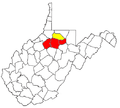
 Map of West Virginia highlighting Harrison County.svg 1,220 × 1,089; 82 KB
-
 Simpson Creek WV map.png 2,750 × 2,125; 5.38 MB
-
 West Virginia Senate District 12 (2010).png 3,543 × 3,081; 786 KB
-
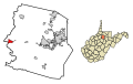
 WVMap-doton-Anmoore.PNG 300 × 262; 11 KB
-
 WVMap-doton-Bridgeport.PNG 300 × 262; 11 KB
-
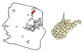
 WVMap-doton-Clarksburg.PNG 300 × 262; 11 KB
-
 WVMap-doton-LostCreek.PNG 300 × 262; 11 KB
-
 WVMap-doton-Lumberport.PNG 300 × 262; 11 KB
-
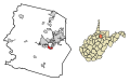
 WVMap-doton-NutterFort.PNG 300 × 262; 11 KB
-
 WVMap-doton-Salem.PNG 300 × 262; 11 KB
-
 WVMap-doton-Shinnston.PNG 300 × 262; 11 KB
-
 WVMap-doton-Stonewood.PNG 300 × 262; 11 KB


.jpg)
.jpg)

.png)


