<nowiki>Category:Maps of Haverhill, Massachusetts; categoría de Wikimedia; kategori Wikimedia; Wikimedia category; د ويکيمېډيا وېشنيزه; Vikimedya kategorisi; ویکیمیڈیا زمرہ; kategória projektov Wikimedia; категорія проєкту Вікімедіа; 维基媒体分类; Wikimedia-Kategorie; Викимедиина категорија; kategorija na Wikimediji; विकिपीडिया:श्रेणी; page de catégorie de Wikimedia; kategorija na Wikimediji; विकिपीडिया वर्ग; категорија на Викимедији; Wikimedia-Kategorie; Wikimedia-kategori; kategori Wikimédia; تصنيف ويكيميديا; pajenn rummata eus Wikimedia; Wikimedia:ကဏ္ဍခွဲခြင်း; 維基媒體分類; Wikimedia категориясы; categoría de Wikimedia; categoria de Wikimedia; Викимедиа категорияһы; tudalen categori Wikimedia; Viciméid catagóir; ردهٔ ویکیپدیا; 维基媒体分类; Wikimedia-kategory; ვიკიპედია:კატეგორიზაცია; ウィキメディアのカテゴリ; categoria Wikimedia; تصنيف بتاع ويكيميديا; විකිමීඩියා ප්රභේද පිටුව; categoria Vicimediorum; Vikipidiya:Shopni; Wikimedia-luokka; Wikimedia category; guruhi Vikimedia; катэгорыя ў праекце Вікімэдыя; Викимедиа проектындагы төркем; catigurìa di nu pruggettu Wikimedia; หน้าหมวดหมู่วิกิมีเดีย; Wikimedia:Kategorija; Wikimedia-Kategorie; Wikimedia:Klassys; категория на Уикимедия; categorie a unui proiect Wikimedia; 維基媒體分類; Wikimedia-kategori; kawan Wikimèdia; 維基媒體分類; 위키미디어 분류; Wikimedia-bólkur; kategorio en Vikimedio; kategori Wikimedia; categoría de Wikimedia; উইকিমিডিয়া বিষয়শ্রেণী; kategori Wikimedia; 维基媒体分类; וויקימעדיע קאַטעגאָריע; kategorija w projektach Wikimedije; thể loại Wikimedia; Wikimedia projekta kategorija; Wikimedia-kategorie; categoria de um projeto da Wikimedia; 维基媒体分类; категорияд Ангилал; Wikimedia-kategori; kategori Wikimedia; پۆلی ویکیمیدیا; Wikimedia category; Vikimédia ñemohenda; Wikimédia-kategória; વિકિપીડિયા શ્રેણી; Wikimediako kategoria; категория в проекте Викимедиа; Wikimedia-Kategorie; катэгорыя ў праекце Вікімедыя; Wikimedia-kategorie; Wîkîmediya:Kategorî; विकिमिडिया श्रेणी; Wikimedia-Kategorie; קטגוריה במיזמי ויקימדיה; Викимедиа проектындагы төркем; κατηγορία εγχειρημάτων Wikimedia; विकिमिडिया श्रेणी; kategoria w projekcie Wikimedia; Wikimedia-kategoriija; гурӯҳи Викимедиа; 維基媒體分類; Wikimedia:Ronnaghys; Wikimedia-Kategorie; categoria di un progetto Wikimedia; Վիքիմեդիայի նախագծի կատեգորիա; Wikimedia category; categurìa 'e nu pruggette Wikimedia; 維基媒體分類; Wikimedia kategooria; Wikimedia-categorie; kategorya ng Wikimedia; гурӯҳи Викимедиа; ẹ̀ka Wikimedia; kategorie na projektech Wikimedia; categoria de um projeto da Wikimedia; Wikimedia-Kategorie; Wikimedia-categorie; tumbung Wikimedia; kategoria ti Wikimedia; kategorija Wikimedie; Wikimedia proyektındağı törkem; Wikimedia-kategori; Kategoriya ning Wikimedia; kategori Wikimedia; jamii ya Wikimedia; വിക്കിമീഡിയ വർഗ്ഗം; Wikimedia-categorie; kategori Wikimedia; விக்கிமீடியப் பகுப்பு; زمرو:وڪيپيڊيا زمرا بندي; Wikimedia-Kategorie; categoría de Wikimedia; kategori e Wikimedias; 维基媒体分类; विकिमीडिया श्रेणी</nowiki>
Subcategories
This category has only the following subcategory.


 1851 Haverhill Massachusetts map byWalling BPL 12709.png 825 × 698; 982 KB
 1876 bird's eye view map of Haverhill, Massachusetts.jpg 9,224 × 5,856; 7.77 MB
 1893 bird's eye view map of Haverhill, Massachusetts.jpg 10,288 × 7,448; 11.86 MB
 City of Haverhill, Massachusetts (9472522165).jpg 800 × 559; 107 KB
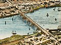 Haverhill Bridge and station on 1893 bird's eye view map.jpg 1,630 × 1,211; 459 KB
 Haverhill ma highlight.png 788 × 466; 54 KB
 Haverhill station on 1876 bird's eye view map.jpg 623 × 461; 69 KB
 Haverhill station on 1893 bird's eye view map.jpg 1,241 × 838; 285 KB
 HaverhillRaid1708.png 948 × 1,152; 2.21 MB
 Map of the town of Haverhill, Essex County, Mass. (3369703211).jpg 1,613 × 2,000; 3.11 MB
 Map of the town of Haverhill, Essex County, Mass. LOC 2004631170.jpg 8,739 × 10,502; 13.8 MB
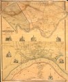 Map of the town of Haverhill, Essex County, Mass. LOC 2004631170.tif 8,739 × 10,502; 262.58 MB


.jpg)


.jpg)

