Category:Maps of Kingdom of Westphalia
Wikimedia category | |||||
| Upload media | |||||
| Instance of | |||||
|---|---|---|---|---|---|
| Category combines topics | |||||
| Kingdom of Westphalia | |||||
former country  _2.svg) .svg) | |||||
| Instance of | |||||
| Location |
| ||||
| Capital | |||||
| Basic form of government | |||||
| Currency |
| ||||
| Head of state | |||||
| Inception |
| ||||
| Dissolved, abolished or demolished date |
| ||||
| Religion or worldview | |||||
| Follows |
| ||||
 | |||||
Subcategories
This category has the following 6 subcategories, out of 6 total.
Media in category "Maps of Kingdom of Westphalia"
The following 25 files are in this category, out of 25 total.
-
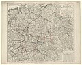
 01 kgr- 1809.jpg 700 × 600; 167 KB
-
 05 Harz 1809.jpg 1,649 × 1,466; 489 KB
-
 08 Saale 1812.jpg 1,603 × 1,460; 530 KB
-
 1807 Oker-Leine-Harz.JPG 1,273 × 855; 142 KB
-
-
 Hanse-Departments.png 2,362 × 1,709; 1.28 MB
-
-
 1811k Aller ok.JPG 1,177 × 889; 171 KB
-
 1811k Aller.JPG 1,180 × 1,032; 300 KB
-
 07 Elbe 1809.jpg 1,303 × 1,426; 493 KB
-
 1807 Dept-Elbe neu.JPG 532 × 719; 71 KB
-
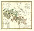
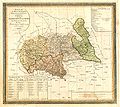
 Karte des Königreichs Westphalen.jpg 3,000 × 2,558; 1.71 MB
-
 Kingdom of Westphalia (1812).svg 450 × 456; 611 KB
-
 Kingdom of Westphalia 1812.svg 450 × 456; 607 KB
-
 Koenigreich westphalen 1811.png 3,000 × 3,442; 19.22 MB
-
 04 Leine 1809.JPG 942 × 803; 234 KB
-
 1807 k-dept-Leine.JPG 728 × 939; 96 KB
-
 1809 Leine-Dept ok.JPG 694 × 857; 98 KB
-
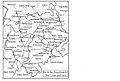
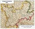
 Map Kingdom of Westphalia.jpg 348 × 409; 68 KB
-
 Map-RB-1812-Westphalia.svg 698 × 999; 796 KB
-
 06 Oker 1809.jpg 1,436 × 1,284; 474 KB
-
 1807 k-dept-Oker.JPG 1,288 × 942; 156 KB
-
 08 Saale 1809.jpg 1,545 × 1,355; 472 KB
-
 1807 Dept-Saale.JPG 650 × 497; 76 KB
-
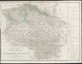
 Westfalen.jpg 1,036 × 845; 361 KB


