Category:Maps of Lézignan
Wikimedia category | |||||
| Upload media | |||||
| Instance of | |||||
|---|---|---|---|---|---|
| Category combines topics | |||||
| Lézignan | |||||
commune in Hautes-Pyrénées, France    | |||||
| Instance of | |||||
| Location | |||||
| Population |
| ||||
| Area |
| ||||
| Elevation above sea level |
| ||||
 | |||||
Subcategories
This category has the following 4 subcategories, out of 4 total.
A
E
- Ecological maps of Lézignan (3 F)
G
- Geological maps of Lézignan (4 F)
M
- Maps of land use in Lézignan (3 F)
Media in category "Maps of Lézignan"
The following 4 files are in this category, out of 4 total.
-
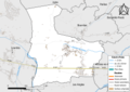
 65271-Lézignan - Localisation.png 2,000 × 2,480; 1.04 MB
-
 65271-Lézignan-Hydro.png 7,015 × 4,960; 3.73 MB
-
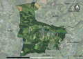 65271-Lézignan-Orthophoto.png 7,015 × 4,960; 4.12 MB
-
 Map commune FR insee code 65271.png 756 × 605; 28 KB


