Category:Maps of La Bastide-du-Salat
Wikimedia category | |||||
| Upload media | |||||
| Instance of | |||||
|---|---|---|---|---|---|
| Category combines topics | |||||
| La Bastide-du-Salat | |||||
commune in Ariège, France   | |||||
| Instance of | |||||
| Named after | |||||
| Location |
| ||||
| Located in or next to body of water | |||||
| Street address |
| ||||
| Population |
| ||||
| Area |
| ||||
| Elevation above sea level |
| ||||
 | |||||
Media in category "Maps of La Bastide-du-Salat"
The following 10 files are in this category, out of 10 total.
-
 09041-La Bastide-du-Salat-argile.png 4,076 × 3,307; 3.38 MB
-
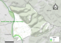
 09041-La Bastide-du-Salat-Natura2000.png 7,015 × 4,960; 5.92 MB
-
 09041-La Bastide-du-Salat-Natura2000b.png 5,846 × 4,133; 5.38 MB
-
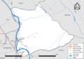 09041-La Bastide-du-Salat-Routes-Hydro.png 3,507 × 2,480; 1.17 MB
-
 09041-La Bastide-du-Salat-ZNIEFF1.png 3,519 × 2,480; 3.5 MB
-
 09041-La Bastide-du-Salat-ZNIEFF2.png 3,519 × 2,480; 3.26 MB
-
 La Bastide-du-Salat OSM 01.png 944 × 814; 763 KB
-
 La Bastide-du-Salat OSM 02.png 944 × 814; 1.54 MB
-
 La Bastide-du-Salat OSM 03.png 1,228 × 1,040; 1.68 MB
-
 Map commune FR insee code 09041.png 756 × 605; 36 KB


