Category:Maps of Lauderdale County, Tennessee
Counties of Tennessee: Anderson · Bedford · Benton · Bledsoe · Blount · Bradley · Campbell · Cannon · Carroll · Carter · Cheatham · Chester · Claiborne · Clay · Cocke · Coffee · Crockett · Cumberland · Davidson · Decatur · DeKalb · Dickson · Dyer · Fayette · Fentress · Franklin · Gibson · Giles · Grainger · Greene · Grundy · Hamblen · Hamilton · Hancock · Hardeman · Hardin · Hawkins · Haywood · Henderson · Henry · Hickman · Houston · Humphreys · Jackson · Jefferson · Johnson · Knox · Lake · Lauderdale · Lawrence · Lewis · Lincoln · Loudon · Macon · Madison · Marion · Marshall · Maury · McMinn · McNairy · Meigs · Monroe · Montgomery · Moore · Morgan · Obion · Overton · Perry · Pickett · Polk · Putnam · Rhea · Roane · Robertson · Rutherford · Scott · Sequatchie · Sevier · Shelby · Smith · Stewart · Sullivan · Sumner · Tipton · Trousdale · Unicoi · Union · Van Buren · Warren · Washington · Wayne · Weakley · White · Williamson · Wilson
Wikimedia category | |||||
| Upload media | |||||
| Instance of | |||||
|---|---|---|---|---|---|
| Category combines topics | |||||
| Lauderdale County | |||||
county in Tennessee, United States   | |||||
| Instance of | |||||
| Named after |
| ||||
| Location | Tennessee | ||||
| Capital | |||||
| Inception |
| ||||
| Population |
| ||||
| Area |
| ||||
| Different from | |||||
| official website | |||||
 | |||||
Media in category "Maps of Lauderdale County, Tennessee"
The following 16 files are in this category, out of 16 total.
-
 Fort Pillow Battlefield Tennessee.jpg 1,580 × 1,210; 1.2 MB
-
 Fort Pillow State Park TN 14 museum map schematic plan for Ft Pillow.jpg 1,024 × 1,365; 839 KB
-

-

-

-

-

-

-

-

-
 Lauderdale County Tennessee incorporated and unincorporated areas.svg 835 × 741; 3.54 MB
-
 Lauderdale County Tennessee.png 300 × 75; 6 KB
-
 Map of Tennessee highlighting Lauderdale County.svg 3,907 × 958; 88 KB
-
 Tennessee Senate District 27 (2010).png 3,507 × 2,010; 467 KB
-
 TN 180 map.png 2,255 × 1,286; 85 KB
-
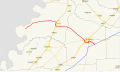 TN 19 map.svg 1,088 × 645; 562 KB


.png)

