Category:Maps of Le Pallet
Wikimedia category | |||||
| Upload media | |||||
| Instance of | |||||
|---|---|---|---|---|---|
| Category combines topics | |||||
| Le Pallet | |||||
commune in Loire-Atlantique, France .jpg) .svg)  | |||||
| Pronunciation audio | |||||
| Instance of | |||||
| Location |
| ||||
| Population |
| ||||
| Area |
| ||||
| official website | |||||
 | |||||
Media in category "Maps of Le Pallet"
The following 4 files are in this category, out of 4 total.
-
 Location Le Pallet.svg 400 × 320; 12 KB
-
 44117-Le Pallet-Hydro.jpeg 5,846 × 4,133; 2.52 MB
-
 44117-Le Pallet-Sols.png 3,270 × 2,598; 3.02 MB
-
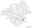
 Map commune FR insee code 44117.png 756 × 605; 49 KB


