Category:Maps of Leeuwarden
Wikimedia category | |||||
| Upload media | |||||
| Instance of | |||||
|---|---|---|---|---|---|
| Category combines topics | |||||
| Leeuwarden | |||||
capital city of Friesland, the Netherlands | |||||
| Instance of |
| ||||
| Location |
| ||||
| Inception |
| ||||
| Population |
| ||||
| Area |
| ||||
| Elevation above sea level |
| ||||
| Replaces | |||||
| official website | |||||
 | |||||
Subcategories
This category has the following 2 subcategories, out of 2 total.
O
Media in category "Maps of Leeuwarden"
The following 55 files are in this category, out of 55 total.
-
Rijksbeschermd stads- of dorpsgezicht - Leeuwarden - Hollanderwijk.png 2,016 × 2,267; 62 KB
-
Rijksbeschermd stads- of dorpsgezicht - Leeuwarden - Nieuwe Kanaalgebied.png 2,016 × 2,267; 146 KB
-
Rijksbeschermd stads- of dorpsgezicht - Leeuwarden - Noorder- - Westersingel.png 2,016 × 2,267; 180 KB
-
Rijksbeschermd stads- of dorpsgezicht - Leeuwarden.png 2,016 × 2,267; 207 KB
-
Aanleg bij Hoeksterpoort - Leeuwarden - 20133092 - RCE.jpg 3,070 × 3,058; 2.77 MB
-
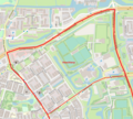
Achter de Hoven Leeuwarden OSM.jpg 1,912 × 1,221; 722 KB
-
Aldlan locatie.JPG 1,024 × 640; 171 KB
-
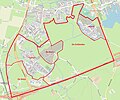
Aldlân & De Hemrik Leeuwarden OSM.jpg 2,210 × 1,154; 873 KB
-
Beplanting bastion achter justitiegebouw - Leeuwarden - 20133087 - RCE.jpg 3,046 × 3,064; 2.5 MB
-
Bilgaard & Havankpark e.o. Leeuwarden OSM.png 2,085 × 1,739; 4.38 MB
-
Bilgaard Leeuwarden OSM.png 1,869 × 825; 2.35 MB
-
Binnenstad Leeuwarden buurten.jpg 3,551 × 3,445; 5.02 MB
-
Blitsaerd Leeuwarden OSM.jpg 1,342 × 379; 125 KB
-
Camminghaburen eo Leeuwarden OSM.png 2,629 × 1,871; 4.51 MB
-
Camminghaburen locatie.JPG 1,024 × 640; 171 KB
-
De Zuidlanden Leeuwarden OSM.jpg 1,492 × 1,239; 440 KB
-
Fvc.JPG 1,024 × 640; 174 KB
-
Heechterp & Schieringen Leeuwarden OSM.png 1,633 × 1,925; 5.2 MB
-
Heechterp Leeuwarden OSM.png 1,239 × 1,116; 2.39 MB
-
Hempens Teerns & Zuiderburen Leeuwarden OSM.jpg 1,649 × 1,224; 496 KB
-
Hollanderwijk Leeuwarden OSM.jpg 1,936 × 985; 657 KB
-
Huizum-West OSM.jpg 1,393 × 1,092; 565 KB
-
Julianapark Leeuwarden OSM.jpg 1,335 × 1,056; 486 KB
-
Kaart leeuwarden vosseparkwijk harlingervaart frieslandhal.svg 761 × 493; 44 KB
-
Leeuwarden — Map of Leeuwarden in De Skeve Toren.jpg 3,000 × 4,000; 4.12 MB
-
Leeuwarden-centrum-OpenTopo.jpg 4,934 × 3,992; 7.13 MB
-
Leeuwarden-centrum-topo-Willemskade.jpg 1,751 × 608; 397 KB
-
Leeuwarden-plaats-OpenTopo.jpg 2,799 × 2,225; 3.52 MB
-
Leeuwarden-stad-2014Q1.jpg 2,844 × 2,379; 3.54 MB
-
Leeuwarden-stad-OpenTopo.jpg 4,088 × 3,153; 4.69 MB
-
Leeuwarden-topografie.jpg 1,910 × 1,861; 2.31 MB
-
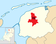
LocatiestadLeeuwarden.png 773 × 359; 155 KB
-
Map - NL - Leeuwarden (2009).svg 625 × 575; 1.56 MB
-
Map NL - Leeuwarden (2007) - Achter de Hoven.PNG 483 × 512; 27 KB
-
Map NL - Leeuwarden (2007) - Aldlân.PNG 483 × 512; 27 KB
-
Map NL - Leeuwarden (2007) - Bilgaard.PNG 483 × 512; 27 KB
-
Map NL - Leeuwarden (2007) - Hoek.PNG 483 × 512; 27 KB
-
Map NL - Leeuwarden (2007) - Nijlân.PNG 483 × 512; 27 KB
-
Map NL - Leeuwarden (2007) - Oldehove.PNG 483 × 512; 27 KB
-
Map NL - Leeuwarden (2007) - Rengerspark.PNG 483 × 512; 27 KB
-
Map NL - Leeuwarden (2007) - Transvaalwijk.PNG 483 × 512; 27 KB
-
Map NL - Leeuwarden (2007) - Valeriuskwartier.PNG 483 × 512; 27 KB
-
Map NL - Leeuwarden (2007) - Vossepark.PNG 483 × 512; 27 KB
-
Map NL - Leeuwarden (2007) - Vrijheidswijk.PNG 483 × 512; 27 KB
-
Map NL - Leeuwarden (2007) - Westeinde.PNG 483 × 512; 27 KB
-
Middelsee Leeuwarden OSM.png 1,400 × 1,904; 1.94 MB
-
Nieuwestad Leeuwarden buurt.jpg 1,191 × 792; 363 KB
-
Nijlân & De Zwette Leeuwarden OSM.png 1,171 × 1,531; 2.6 MB
-
Oud-Oost Leeuwarden OSM.png 1,529 × 1,553; 4.33 MB
-
Potmargezone Leeuwarden OSM.png 2,499 × 1,715; 7.47 MB
-
Sonnenborgh e.o. Leeuwarden OSM.png 2,054 × 1,566; 5.33 MB
-
Vossepark & Helicon Leeuwarden OSM.jpg 1,462 × 1,027; 494 KB
-
Vrijheidswijk Leeuwarden OSM.jpg 1,789 × 661; 376 KB
-
Westeinde e.o. Leeuwarden OSM.png 1,685 × 2,035; 3.47 MB


