<nowiki>Catégorie:Carte géographique des Allues; Category:Maps of Les Allues; categoría de Wikimedia; категория на Уикимедия; Vikimedya kategorisi; categurìa 'e nu pruggette Wikimedia; Wikimedia-kategori; категорія проєкту Вікімедіа; kawan Wikimèdia; 維基媒體分類; Wikimedia-Kategorie; 위키미디어 분류; kategorio en Vikimedio; Викимедиина категорија; kategorija na Wikimediji; categoría de Wikimedia; উইকিমিডিয়া বিষয়শ্রেণী; page de catégorie de Wikimedia; kategorija na Wikimediji; וויקימעדיע קאַטעגאָריע; thể loại Wikimedia; Wikimedia projekta kategorija; Wikimedia-kategorie; категорија на Викимедији; categoria de um projeto da Wikimedia; Wikimedia category; Wikimedia-Kategorie; Wikimedia-kategori; Wikimedia-kategori; پۆلی ویکیمیدیا; Wikimedia category; تصنيف ويكيميديا; pajenn rummata eus Wikimedia; 維基媒體分類; Wikimédia-kategória; વિકિપીડિયા શ્રેણી; Wikimediako kategoria; categoría de Wikimedia; Wikimedia-categorie; Викимедиа категорияһы; tudalen categori Wikimedia; kategori e Wikimedias; Վիքիմեդիայի նախագծի կատեգորիա; 维基媒体分类; Wikimedia-kategory; ウィキメディアのカテゴリ; קטגוריה במיזמי ויקימדיה; विकिमीडिया श्रेणी; Wikimedia-luokka; гурӯҳи Викимедиа; Wikimedia-categorie; guruhi Vikimedia; categoria di un progetto Wikimedia; kategoria ti Wikimedia; κατηγορία εγχειρημάτων Wikimedia; катэгорыя ў праекце Вікімэдыя; Wikimedia kategooria; categorie a unui proiect Wikimedia; kategorie na projektech Wikimedia; категория в проекте Викимедиа; ẹ̀ka Wikimedia; Wikimedia-kategori; categoria de um projeto da Wikimedia; Wikimedia категориясы; Wikimedia-kategoriija; tumbung Wikimedia; ردهٔ ویکیپدیا; kategorija Wikimedie; kategoria w projekcie Wikimedia; Wikimedia-Kategorie; Wikimedia-Kategorie; kategori Wikimedia; jamii ya Wikimedia; categoria de Wikimedia; Wikimedia-categorie; kategori Wikimedia; Wikimedia-Kategorie; विकिपीडिया:श्रेणी; катэгорыя ў праекце Вікімедыя; categoría de Wikimedia; kategória projektov Wikimedia; 维基媒体分类; гурӯҳи Викимедиа</nowiki>


 73015-Les Allues - Localisation.png 3,507 × 2,480; 1.1 MB
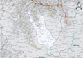 73015-Les Allues-Cadastre.png 7,015 × 4,960; 14.05 MB
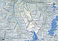 73015-Les Allues-Hydro.jpeg 5,846 × 4,133; 4.5 MB
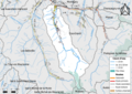 73015-Les Allues-Hydro.png 7,015 × 4,960; 5.55 MB
 73015-Les Allues-Natura 2000.png 7,015 × 4,960; 5.24 MB
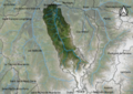 73015-Les Allues-Orthophoto.png 7,015 × 4,960; 69.46 MB
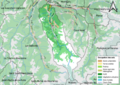 73015-Les Allues-Sols.png 7,015 × 4,960; 6.77 MB
 73015-Les Allues-ZNIEFF1.png 7,015 × 4,960; 5.96 MB
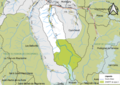 73015-Les Allues-ZNIEFF2.png 7,015 × 4,960; 5.25 MB
 Map commune FR insee code 73015.png 756 × 605; 123 KB
 Périmètre RNN Plan de Tuéda rnn100.png 1,237 × 824; 625 KB


