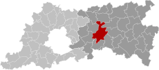
Category:Maps of Leuven
Wikimedia category | |||||
| Upload media | |||||
| Instance of | |||||
|---|---|---|---|---|---|
| Category combines topics | |||||
| Leuven | |||||
capital city of Flemish Brabant, Belgium | |||||
| Pronunciation audio | |||||
| Instance of | |||||
| Part of |
| ||||
| Location | Arrondissement of Leuven, Flemish Brabant, Flemish Region, Belgium | ||||
| Located in or next to body of water | |||||
| Capital |
| ||||
| Official language | |||||
| Head of government |
| ||||
| Legal form |
| ||||
| Significant event | |||||
| Population |
| ||||
| Area |
| ||||
| Elevation above sea level |
| ||||
| Different from | |||||
| official website | |||||
 | |||||
Media in category "Maps of Leuven"
The following 18 files are in this category, out of 18 total.
-
Eerste stadsmuur van leuven-restanten.png 458 × 354; 120 KB
-
Egenhoven OpenStreetMap.png 1,973 × 1,976; 1.46 MB
-
Haasrode Leuven Location.png 1,200 × 800; 84 KB
-
Heverlee Leuven Location.png 1,200 × 800; 86 KB
-
Kessel-Lo Leuven Location.png 1,200 × 800; 84 KB
-
Korbeek-Lo Leuven Location.png 1,200 × 800; 84 KB
-
Leuven Flemish-Brabant Belgium Map.svg 1,047 × 464; 3.1 MB
-
LeuvenLocatie.png 270 × 203; 5 KB
-
Leuvens korbeeklo kaart OSM.png 1,432 × 828; 1.2 MB
-
Louvain OSM 01.png 395 × 566; 427 KB
-
Louvain OSM 02.png 395 × 566; 545 KB
-
Louvain OSM 03.png 513 × 488; 472 KB
-
Map Leuven.jpg 550 × 552; 257 KB
-
Map Nieuw Kwartier Leuven.svg 398 × 224; 64 KB
-
Map of Leuven in belgium-viol-reddot-t.png 399 × 335; 10 KB
-
Muntstraat Leuven.jpg 638 × 651; 197 KB
-
Wijgmaal Leuven Location.png 1,200 × 800; 84 KB
-
Wilsele Leuven Location.png 1,200 × 800; 84 KB


