Category:Maps of Lignerolles (Indre)
Wikimedia category | |||||
| Upload media | |||||
| Instance of | |||||
|---|---|---|---|---|---|
| Category combines topics | |||||
| Lignerolles | |||||
commune in Indre, France _-_Mairie.jpg)  | |||||
| Instance of | |||||
| Location | |||||
| Population |
| ||||
| Area |
| ||||
| Different from | |||||
 | |||||
Media in category "Maps of Lignerolles (Indre)"
The following 2 files are in this category, out of 2 total.
-
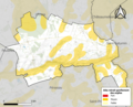 36095-Lignerolles-argile.png 3,057 × 2,480; 3.01 MB
-
 36095-Lignerolles-Hydro.jpeg 5,846 × 4,133; 1.77 MB

