Category:Maps of Lortet
Wikimedia category | |||||
| Upload media | |||||
| Instance of | |||||
|---|---|---|---|---|---|
| Category combines topics | |||||
| Lortet | |||||
commune in Hautes-Pyrénées, France _1.jpg) .svg)  | |||||
| Instance of | |||||
| Location |
| ||||
| Population |
| ||||
| Area |
| ||||
| Elevation above sea level |
| ||||
 | |||||
Media in category "Maps of Lortet"
This category contains only the following file.
-
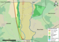 65279-Lortet-Sols.png 7,015 × 4,960; 3.35 MB
