Category:Maps of Luçay-le-Libre
Wikimedia category | |||||
| Upload media | |||||
| Instance of | |||||
|---|---|---|---|---|---|
| Category combines topics | |||||
| Luçay-le-Libre | |||||
commune in Indre, France   | |||||
| Instance of | |||||
| Location | |||||
| Street address |
| ||||
| Population |
| ||||
| Area |
| ||||
 | |||||
Media in category "Maps of Luçay-le-Libre"
The following 4 files are in this category, out of 4 total.
-
 36102-Luçay-le-Libre-argile.png 3,057 × 2,480; 1.59 MB
-
 36102-Luçay-le-Libre-Hydro.jpeg 5,846 × 4,133; 1.01 MB
-
 36102-Luçay-le-Libre-Sols.png 3,270 × 2,598; 972 KB
-
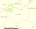 Map commune FR insee code 36102.png 756 × 605; 24 KB


