Category:Maps of Lugan (Tarn)
Wikimedia category | |||||
| Upload media | |||||
| Instance of | |||||
|---|---|---|---|---|---|
| Category combines topics | |||||
| Lugan | |||||
commune in Tarn, France  .svg)  | |||||
| Instance of | |||||
| Location |
| ||||
| Population |
| ||||
| Area |
| ||||
| Elevation above sea level |
| ||||
| Different from | |||||
| official website | |||||
 | |||||
Media in category "Maps of Lugan (Tarn)"
The following 5 files are in this category, out of 5 total.
-
 81150-Lugan-argile.jpg 3,057 × 2,480; 468 KB
-
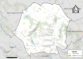
 81150-Lugan-Natura2000.png 5,846 × 4,133; 4.21 MB
-
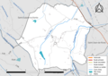 81150-Lugan-Routes-Hydro.png 3,507 × 2,480; 1.51 MB
-
 81150-Lugan-ZNIEFF1.jpg 3,519 × 2,480; 522 KB
-
 81150-Lugan-ZNIEFF2.png 3,519 × 2,480; 3.13 MB


