Category:Maps of Luhansk
Wikimedia category | |||||
| Upload media | |||||
| Instance of | |||||
|---|---|---|---|---|---|
| Category combines topics | |||||
| Luhansk | |||||
city and administrative centre of Luhansk Oblast, Ukraine      | |||||
| Instance of |
| ||||
| Named after |
| ||||
| Location |
| ||||
| Official language | |||||
| Head of government | |||||
| Inception |
| ||||
| Significant event |
| ||||
| Population |
| ||||
| Area |
| ||||
| Elevation above sea level |
| ||||
| official website | |||||
 | |||||
Media in category "Maps of Luhansk"
The following 39 files are in this category, out of 39 total.
-
 1902. План Луганска.jpg 6,144 × 5,228; 3.23 MB
-
 Centre Old Luhansk Map 1879.jpg 1,840 × 2,282; 3.1 MB
-
 Dal street (Luhansk).png 866 × 314; 67 KB
-
 Demiokhin street.png 456 × 580; 90 KB
-
 Demiokhina - Centre Old Luhansk Map 1879.jpg 1,840 × 2,282; 2.9 MB
-
 Flag Map Of Luhansk (Ukraine).png 2,388 × 2,901; 456 KB
-
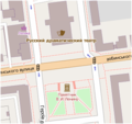
 Gorky Square map 01.png 500 × 372; 35 KB
-
 Heroes VVV square.png 174 × 298; 53 KB
-
 Karl Marx street (Luhansk).png 589 × 216; 59 KB
-
 Kotsiubynsky street (Luhansk).png 484 × 174; 51 KB
-
 Lenin Square map.png 417 × 424; 45 KB
-
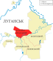
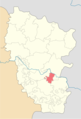
 Lugansk-Raion.png 300 × 410; 74 KB
-
 Luhansk adm division color.svg 787 × 900; 192 KB
-
 Luhansk AR raion ukr.svg 787 × 900; 434 KB
-
 Luhansk KB raion ukr.svg 787 × 900; 434 KB
-
 Luhansk LE raion ukr.svg 787 × 900; 434 KB
-
 Luhansk location map.png 1,037 × 1,233; 1.67 MB
-
 Luhansk location.png 2,000 × 2,944; 407 KB
-
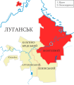
 Luhansk raions eng.svg 787 × 900; 272 KB
-
 Luhansk raions rus.svg 788 × 900; 348 KB
-
 Luhansk raions.svg 787 × 900; 335 KB
-
 Luhansk ZH raion ukr.svg 787 × 900; 434 KB
-
 Luhansk-Ukraine-map.png 1,200 × 799; 80 KB
-
 Map Lugansk foundry.jpg 1,115 × 798; 766 KB
-
 Map of Lugansk ironworks in 1913.jpg 1,262 × 1,200; 415 KB
-
 Mayakovsky Square map.png 437 × 300; 12 KB
-
 Post street (Luhansk).png 449 × 192; 36 KB
-
 Pushkin street (Luhansk).png 477 × 395; 55 KB
-
 Red square (Luhansk).png 295 × 337; 36 KB
-
 Revolution fighters square.png 250 × 324; 28 KB
-
 Revolution square (Luhansk).png 266 × 171; 19 KB
-
 Rosa Luxemburg Square map.png 313 × 270; 25 KB
-
 Russian-occupied territories in map.webp 1,220 × 614; 40 KB
-
 Taras Shevchenko street (Luhansk).png 606 × 172; 48 KB
-
 Theatral Square map.png 305 × 288; 49 KB
-
 Zbirnyj plqan luhansqkoho.png 1,920 × 1,536; 3.1 MB
-
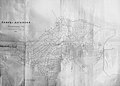
 План Луганска 1879.jpg 8,872 × 4,494; 13.35 MB
-
 План Луганска 1910.jpg 6,200 × 4,138; 11.31 MB
-
 План Луганска 1912.jpg 6,496 × 4,675; 8.01 MB


.png)


.png)
.png)
.png)

.png)


.png)
.png)
.png)
.png)