Category:Maps of Mainsat
Wikimedia category | |||||
| Upload media | |||||
| Instance of | |||||
|---|---|---|---|---|---|
| Category combines topics | |||||
| Mainsat | |||||
commune in Creuse, France   | |||||
| Instance of | |||||
| Location |
| ||||
| Population |
| ||||
| Area |
| ||||
| Elevation above sea level |
| ||||
| official website | |||||
 | |||||
Media in category "Maps of Mainsat"
The following 6 files are in this category, out of 6 total.
-
 23116-Mainsat-argile.jpg 3,057 × 2,480; 1,021 KB
-
 23116-Mainsat-Routes-Hydro.svg 1,056 × 744; 4.67 MB
-
 23116-Mainsat-Sols.png 3,270 × 2,598; 3.07 MB
-
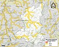
 23116-Mainsat-ZNIEFF1.jpg 3,519 × 2,480; 922 KB
-
 23116-Mainsat-ZNIEFF2.png 5,866 × 4,133; 10.86 MB
-
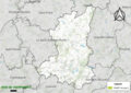
 Map commune FR insee code 23116.png 756 × 605; 53 KB


