Category:Maps of Marche
- Regions of Italy: Abruzzo · Aosta Valley · Apulia · Basilicata · Calabria · Campania · Emilia-Romagna · Friuli-Venezia Giulia · Lazio · Liguria · Lombardy · Marche · Molise · Piedmont · Sardinia · Sicily · Trentino-South Tyrol · Tuscany · Umbria · Veneto
Wikimedia category | |||||
| Upload media | |||||
| Instance of | |||||
|---|---|---|---|---|---|
| Category combines topics | |||||
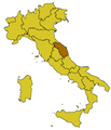
| Marche | |||||
region in Italy     | |||||
| Instance of | |||||
| Location |
| ||||
| Located in or next to body of water | |||||
| Capital | |||||
| Legislative body |
| ||||
| Executive body |
| ||||
| Head of government |
| ||||
| Highest point | |||||
| Population |
| ||||
| Area |
| ||||
| Elevation above sea level |
| ||||
| Different from | |||||
| official website | |||||
 | |||||
Use the appropriate category for maps showing all or a large part of Marche. See subcategories for smaller areas:
| If the map shows | Category to use |
|---|---|
| Marche on a recently created map | Category:Maps of Marche or its subcategories |
| Marche on a map created more than 70 years ago | Category:Old maps of Marche or its subcategories |
| the history of Marche on a recently created map | Category:Maps of the history of Marche or its subcategories |
| the history of Marche on a map created more than 70 years ago | Category:Old maps of the history of Marche or its subcategories |
Subcategories
This category has the following 16 subcategories, out of 16 total.
C
- Plans of churches in Marche (1 F)
E
L
- Linguistic maps of Marche (1 F)
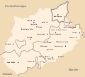
- Location maps of Marche (4 F)
M
O
- OpenStreetMap maps of Marche (14 F)
R
S
- SVG locator maps of Marche (5 F)
T
- Topographic maps of Marche (2 F)
W
- Wine maps of Marche (2 F)
Media in category "Maps of Marche"
The following 45 files are in this category, out of 45 total.
-
 Italy Regions Marche Map.png 220 × 257; 23 KB
-
 MAR-Mappa.png 300 × 350; 21 KB
-
 Regione-Marche-Posizione.png 269 × 314; 24 KB
-
 74 of 'L'Italia geografica illustrata, etc' (11212092054).jpg 2,204 × 3,167; 1.86 MB
-

-
 Central Italian dialects.png 1,099 × 1,004; 102 KB
-
 Circoscrizione Marche (Camera dei Deputati).png 1,632 × 2,112; 122 KB
-
 Dialetti italiani centrali.jpg 327 × 335; 38 KB
-
 Dialetti toscani.jpg 320 × 310; 69 KB
-
 Eccellenza marchigiana 2010-11.png 409 × 417; 29 KB
-
 Fermo in Italy.svg 1,034 × 1,299; 3 MB
-
 Fermo posizione.png 350 × 424; 14 KB
-
 Flag map of Marche.svg 3,526 × 3,476; 47 KB
-
 Frazioni-montegallo.jpg 994 × 566; 226 KB
-
 Map Cultural heritage and environment III 1992 - Touring Club Italiano CART-TEM-114.jpg 5,000 × 3,433; 12.14 MB
-
 Map of Montefeltro.svg 1,680 × 1,520; 97 KB
-
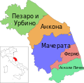 Map of region of Marche, Italy, with provinces-bg.svg 3,504 × 3,450; 117 KB
-
 Map of region of Marche, Italy, with provinces-de.svg 3,504 × 3,450; 114 KB
-
 Map of region of Marche, Italy, with provinces-en.svg 3,504 × 3,450; 114 KB
-
 Map of region of Marche, Italy, with provinces-es.svg 3,504 × 3,450; 114 KB
-
 Map of region of Marche, Italy, with provinces-fr.svg 3,504 × 3,450; 114 KB
-
 Map of region of Marche, Italy, with provinces-it.svg 3,504 × 3,450; 114 KB
-
 Map of region of Marche, Italy.svg 3,504 × 3,450; 75 KB
-
 Map of Valmarecchia.svg 2,899 × 2,658; 63 KB
-
 Mappa Riviera del Conero.svg 744 × 1,052; 229 KB
-
 Mappa Val Mivola.png 1,000 × 741; 72 KB
-
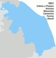 Marche boundary changes (1831).png 580 × 600; 17 KB
-
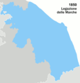 Marche boundary changes (1850).png 580 × 600; 14 KB
-
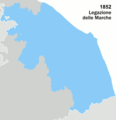 Marche boundary changes (1852).png 580 × 600; 14 KB
-
 Marche boundary changes (1860-a).png 580 × 600; 17 KB
-
 Marche boundary changes (1860-b).png 580 × 600; 16 KB
-
 Marche boundary changes (1923).png 580 × 600; 16 KB
-
 Marche boundary changes (1927).png 580 × 600; 16 KB
-
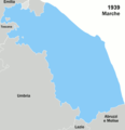 Marche boundary changes (1939).png 580 × 600; 16 KB
-
 Marche boundary changes (2009).png 580 × 600; 15 KB
-
 Marche boundary changes.gif 580 × 600; 155 KB
-
 Marches in Italy.svg 1,034 × 1,299; 1.67 MB
-
 Neapolitan language.jpg 441 × 514; 132 KB
-
 Ordinary statute regions of Italy.svg 735 × 867; 74 KB
-
 Pianta Urbino (Tommaso Luci 1689).jpg 696 × 517; 492 KB
-
 Porto di Fano - Mappa schematica.png 667 × 707; 32 KB
-
 Regione thumb Marche.svg 166 × 161; 187 KB
-
 Riviera del Conero.svg 744 × 1,052; 204 KB
-
 Vias del comercio de los Picenos.svg 340 × 410; 49 KB
-
 Wolf Park map.jpg 301 × 385; 35 KB


.jpg)


.png)


.png)
.png)
.png)
.png)
.png)
.png)
.png)
.png)
.png)


.jpg)


