Category:Maps of Meymac
Wikimedia category | |||||
| Upload media | |||||
| Instance of | |||||
|---|---|---|---|---|---|
| Category combines topics | |||||
| Meymac | |||||
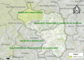
commune in Corrèze, France   .svg)  | |||||
| Instance of | |||||
| Located in protected area | |||||
| Location |
| ||||
| Located in or next to body of water | |||||
| Highest point | |||||
| Population |
| ||||
| Area |
| ||||
| Elevation above sea level |
| ||||
| official website | |||||
 | |||||
Media in category "Maps of Meymac"
The following 7 files are in this category, out of 7 total.
-
 19136-Meymac-argile.jpg 3,057 × 2,480; 1.1 MB
-
 19136-Meymac-Routes-Hydro.png 3,507 × 2,480; 3.47 MB
-
 19136-Meymac-Routes-Hydro.svg 1,056 × 744; 5.71 MB
-
 19136-Meymac-Sols.png 3,270 × 2,598; 3.7 MB
-
 19136-Meymac-ZNIEFF1.jpg 3,519 × 2,480; 1.16 MB
-
 19136-Meymac-ZNIEFF2.png 5,866 × 4,133; 17.46 MB
-
 Map commune FR insee code 19136.png 756 × 605; 86 KB


