Category:Maps of Mirabel (Tarn-et-Garonne)
Wikimedia category | |||||
| Upload media | |||||
| Instance of | |||||
|---|---|---|---|---|---|
| Category combines topics | |||||
| Mirabel | |||||
commune in Tarn-et-Garonne, France  .svg)  | |||||
| Instance of | |||||
| Location |
| ||||
| Located in or next to body of water | |||||
| Population |
| ||||
| Area |
| ||||
| Different from | |||||
| official website | |||||
 | |||||
Media in category "Maps of Mirabel (Tarn-et-Garonne)"
The following 7 files are in this category, out of 7 total.
-
 82110-Mirabel-argile.jpg 3,057 × 2,480; 663 KB
-
 82110-Mirabel-Natura2000.png 5,846 × 4,133; 13.03 MB
-
 82110-Mirabel-Routes-Hydro.png 3,507 × 2,480; 3.09 MB
-
 82110-Mirabel-Sols.png 3,270 × 2,598; 3.08 MB
-
 82110-Mirabel-ZNIEFF1.png 3,057 × 2,480; 6.62 MB
-
 82110-Mirabel-ZNIEFF2.png 3,519 × 2,480; 7.39 MB
-
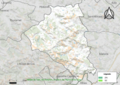
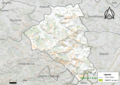
 Map commune FR insee code 82110.png 756 × 605; 76 KB


