Category:Maps of Mondreville (Seine-et-Marne)
Wikimedia category | |||||
| Upload media | |||||
| Instance of | |||||
|---|---|---|---|---|---|
| Category combines topics | |||||
| Mondreville | |||||
commune in Seine-et-Marne, France   | |||||
| Instance of | |||||
| Location |
| ||||
| Head of government |
| ||||
| Population |
| ||||
| Area |
| ||||
| Elevation above sea level |
| ||||
| Different from | |||||
| official website | |||||
 | |||||
Subcategories
This category has only the following subcategory.
Media in category "Maps of Mondreville (Seine-et-Marne)"
The following 10 files are in this category, out of 10 total.
-
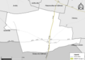
 77297-Mondreville - Localisation.png 2,500 × 2,480; 1.42 MB
-
 77297-Mondreville - Relief-PlanIgn.png 7,015 × 4,960; 4.06 MB
-
 77297-Mondreville-Cadastre.png 7,015 × 4,960; 3.48 MB
-
 77297-Mondreville-Hydro.png 7,015 × 4,960; 1.81 MB
-
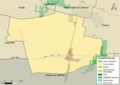
 77297-Mondreville-Natura 2000.png 7,015 × 4,960; 1.6 MB
-
 77297-Mondreville-Orthophoto.png 7,015 × 4,960; 6.85 MB
-
 77297-Mondreville-Sols.png 7,015 × 4,960; 1.83 MB
-
 77297-Mondreville-ZNIEFF1.png 7,015 × 4,960; 1.61 MB
-
 77297-Mondreville-ZNIEFF2.png 7,015 × 4,960; 1.61 MB
-
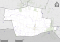
 Map commune FR insee code 77297.png 756 × 605; 40 KB


