Category:Maps of Montdauphin
Wikimedia category | |||||
| Upload media | |||||
| Instance of | |||||
|---|---|---|---|---|---|
| Category combines topics | |||||
| Montdauphin | |||||
commune in Seine-et-Marne, France   | |||||
| Instance of | |||||
| Location |
| ||||
| Head of government |
| ||||
| Population |
| ||||
| Area |
| ||||
 | |||||
Media in category "Maps of Montdauphin"
The following 14 files are in this category, out of 14 total.
-
 77303-Montdauphin - Localisation.png 2,500 × 2,480; 1.42 MB
-
 77303-Montdauphin - Relief-PlanIgn.png 7,015 × 4,960; 6.97 MB
-
 77303-Montdauphin-Cadastre.png 7,015 × 4,960; 4.14 MB
-
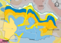 77303-Montdauphin-Géologie.png 7,015 × 4,960; 3.26 MB
-
 77303-Montdauphin-Hydro.png 7,015 × 4,960; 2.61 MB
-
 77303-Montdauphin-Natura 2000.png 7,015 × 4,960; 2.19 MB
-
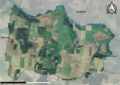 77303-Montdauphin-Orthophoto.png 7,015 × 4,960; 4.07 MB
-
 77303-Montdauphin-Sols.png 7,015 × 4,960; 2.53 MB
-
 77303-Montdauphin-ZNIEFF1.png 7,015 × 4,960; 2.23 MB
-
 77303-Montdauphin-ZNIEFF2.png 7,015 × 4,960; 2.13 MB
-
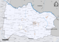
 Map commune FR insee code 77303.png 756 × 605; 29 KB
-
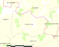
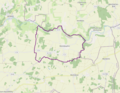
 Montdauphin OSM 01.png 1,066 × 798; 717 KB
-
 Montdauphin OSM 02.png 1,066 × 798; 970 KB
-
 Montdauphin OSM 03.png 1,228 × 956; 1.31 MB


