Category:Maps of Montoulieu (Hérault)
Wikimedia category | |||||
| Upload media | |||||
| Instance of | |||||
|---|---|---|---|---|---|
| Category combines topics | |||||
| Montoulieu | |||||
commune in Hérault, France  .svg)  | |||||
| Instance of | |||||
| Location | |||||
| Population |
| ||||
| Area |
| ||||
| Elevation above sea level |
| ||||
| Different from | |||||
| official website | |||||
 | |||||
Media in category "Maps of Montoulieu (Hérault)"
The following 4 files are in this category, out of 4 total.
-
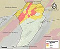 34171-Montoulieu-argile.jpg 3,057 × 2,480; 553 KB
-
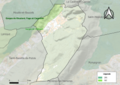 34171-Montoulieu-Natura2000b.png 7,015 × 4,960; 10.31 MB
-
 34171-Montoulieu-ZNIEFF1.png 3,519 × 2,480; 4.68 MB
-
 34171-Montoulieu-ZNIEFF2.png 3,519 × 2,480; 4.39 MB


