Category:Maps of Murs (Indre)
Wikimedia category | |||||
| Upload media | |||||
| Instance of | |||||
|---|---|---|---|---|---|
| Category combines topics | |||||
| Murs | |||||
commune in Indre, France  | |||||
| Instance of | |||||
| Location | |||||
| Street address |
| ||||
| Population |
| ||||
| Area |
| ||||
| Different from | |||||
| official website | |||||
 | |||||
Media in category "Maps of Murs (Indre)"
The following 4 files are in this category, out of 4 total.
-
 36136-Murs-argile.png 3,057 × 2,480; 2.67 MB
-
 36136-Murs-Hydro.jpeg 5,846 × 4,133; 1.88 MB
-
 36136-Murs-Sols.png 3,270 × 2,598; 2.04 MB
-
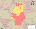
 Map commune FR insee code 36136.png 756 × 605; 57 KB


