Category:Maps of Nümbrecht
Wikimedia category | |||||
| Upload media | |||||
| Instance of | |||||
|---|---|---|---|---|---|
| Category combines topics | |||||
| Nümbrecht | |||||
municipality in the Oberbergischer Kreis, in Northrhine-Westfalia, Germany    | |||||
| Instance of |
| ||||
| Location | |||||
| Population |
| ||||
| Area |
| ||||
| Elevation above sea level |
| ||||
| official website | |||||
 | |||||
Media in category "Maps of Nümbrecht"
The following 58 files are in this category, out of 58 total.
-
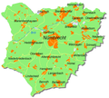 Karte-nümbrecht.png 1,216 × 1,090; 475 KB
-
 Kurpark-sgv.jpg 534 × 475; 57 KB
-
 Nümbrecht in GM.svg 389 × 473; 299 KB
-
 Nümbrecht-lage-ahebruch.png 1,178 × 1,212; 451 KB
-
 Nümbrecht-lage-ahlbusch.png 1,178 × 1,212; 443 KB
-
 Nümbrecht-lage-alsbach.png 1,178 × 1,213; 451 KB
-
 Nümbrecht-lage-altennümbrecht.png 1,178 × 1,213; 432 KB
-
 Nümbrecht-lage-aufderhardt.png 1,178 × 1,213; 465 KB
-
 Nümbrecht-lage-benroth.png 1,178 × 1,213; 440 KB
-
 Nümbrecht-lage-bierenbachtal.png 1,178 × 1,214; 466 KB
-
 Nümbrecht-lage-birkenbach.png 1,178 × 1,214; 460 KB
-
 Nümbrecht-lage-breunfeld.png 1,178 × 1,214; 460 KB
-
 Nümbrecht-lage-brünglinghausen.png 1,178 × 1,213; 440 KB
-
 Nümbrecht-lage-buch.png 1,178 × 1,213; 452 KB
-
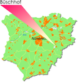 Nümbrecht-lage-büschhof.png 1,178 × 1,214; 453 KB
-
 Nümbrecht-lage-drinsahl.png 1,178 × 1,214; 457 KB
-
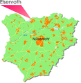 Nümbrecht-lage-elsenroth.png 1,178 × 1,212; 458 KB
-
 Nümbrecht-lage-erlinghausen.png 1,178 × 1,214; 456 KB
-
 Nümbrecht-lage-friedenthal.png 1,178 × 1,214; 451 KB
-
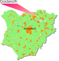 Nümbrecht-lage-gaderoth.png 1,178 × 1,213; 464 KB
-
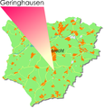 Nümbrecht-lage-gehringhausen.png 1,178 × 1,214; 431 KB
-
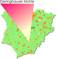 Nümbrecht-lage-gehringhausermühle.png 1,178 × 1,214; 406 KB
-
 Nümbrecht-lage-grunewald.png 1,178 × 1,212; 443 KB
-
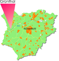 Nümbrecht-lage-grünthal.png 1,178 × 1,213; 453 KB
-
 Nümbrecht-lage-guxmühlen.png 1,178 × 1,213; 450 KB
-
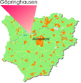 Nümbrecht-lage-göpringhausen.png 1,178 × 1,214; 457 KB
-
 Nümbrecht-lage-hardt.png 1,178 × 1,213; 452 KB
-
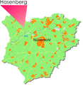 Nümbrecht-lage-hasenberg.png 1,178 × 1,213; 457 KB
-
 Nümbrecht-lage-heddinghausen.png 1,178 × 1,214; 445 KB
-
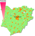 Nümbrecht-lage-heide.png 1,178 × 1,213; 454 KB
-
 Nümbrecht-lage-heisterstock.png 1,178 × 1,214; 466 KB
-
 Nümbrecht-lage-hillenbach.png 1,178 × 1,214; 456 KB
-
 Nümbrecht-lage-hochstraßen.png 1,178 × 1,214; 452 KB
-
 Nümbrecht-lage-homburgbröl.png 1,178 × 1,213; 455 KB
-
 Nümbrecht-lage-homburgerpapiermühle.png 1,178 × 1,213; 459 KB
-
 Nümbrecht-lage-huppichteroth.png 1,178 × 1,214; 456 KB
-
 Nümbrecht-lage-höferhof.png 1,178 × 1,214; 454 KB
-
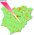 Nümbrecht-lage-hömel.png 1,178 × 1,213; 443 KB
-
 Nümbrecht-lage-kleinhöhe.png 1,178 × 1,214; 454 KB
-
 Nümbrecht-lage-krahm.png 1,178 × 1,212; 451 KB
-
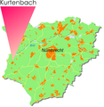 Nümbrecht-lage-kurtenbach.png 1,178 × 1,213; 445 KB
-
 Nümbrecht-lage-langenbach.png 1,178 × 1,212; 424 KB
-
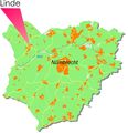 Nümbrecht-lage-linde.png 1,178 × 1,214; 454 KB
-
 Nümbrecht-lage-lindscheid.png 1,178 × 1,214; 438 KB
-
 Nümbrecht-lage-lindscheidermühle.png 1,178 × 1,214; 408 KB
-
 Nümbrecht-lage-löhe.png 1,178 × 1,213; 453 KB
-
 Nümbrecht-lage-malzhagen.png 1,178 × 1,213; 459 KB
-
 Nümbrecht-lage-mildsiefen.png 1,178 × 1,214; 442 KB
-
 Nümbrecht-lage-mühlenthal.png 1,178 × 1,213; 457 KB
-
 Nümbrecht-lage-nallingen.png 1,178 × 1,214; 456 KB
-
 Nümbrecht-lage-neuenberg.png 1,178 × 1,213; 455 KB
-
 Nümbrecht-lage-neuroth.png 1,178 × 1,213; 440 KB
-
 Nümbrecht-lage-niederbröl.png 1,178 × 1,214; 455 KB
-
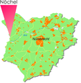 Nümbrecht-lage-nöchel.png 1,178 × 1,213; 454 KB
-
 Nümbrecht-lage-oberbierenbach.png 1,178 × 1,213; 470 KB
-
 Nümbrecht-lage-röttgen.png 1,178 × 1,213; 457 KB
-
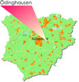 Nümbrecht-lage-ödinghausen.png 1,178 × 1,223; 454 KB
-
 Nümbrecht-lage-überdorf.png 1,178 × 1,223; 455 KB


