Category:Maps of Nash County, North Carolina
Counties of North Carolina: Alamance · Alexander · Alleghany · Anson · Ashe · Avery · Beaufort · Bertie · Bladen · Brunswick · Buncombe · Burke · Cabarrus · Caldwell · Camden · Carteret · Caswell · Catawba · Chatham · Cherokee · Chowan · Clay · Cleveland · Columbus · Craven · Cumberland · Currituck · Dare · Davidson · Davie · Duplin · Durham · Edgecombe · Forsyth · Franklin · Gaston · Gates · Graham · Granville · Greene · Guilford · Halifax · Harnett · Haywood · Henderson · Hertford · Hoke · Hyde · Iredell · Jackson · Johnston · Jones · Lee · Lenoir · Lincoln · Macon · Madison · Martin · McDowell · Mecklenburg · Mitchell · Montgomery · Moore · Nash · New Hanover · Northampton · Onslow · Orange · Pamlico · Pasquotank · Pender · Perquimans · Person · Pitt · Polk · Randolph · Richmond · Robeson · Rockingham · Rowan · Rutherford · Sampson · Scotland · Stanly · Stokes · Surry · Swain · Transylvania · Tyrrell · Union · Vance · Wake · Warren · Washington · Watauga · Wayne · Wilkes · Wilson · Yadkin · Yancey
Wikimedia category | |||||
| Upload media | |||||
| Instance of | |||||
|---|---|---|---|---|---|
| Category combines topics | |||||
| Nash County | |||||
county in North Carolina, United States   | |||||
| Instance of | |||||
| Named after |
| ||||
| Location | North Carolina | ||||
| Capital |
| ||||
| Inception |
| ||||
| Population |
| ||||
| Area |
| ||||
| official website | |||||
 | |||||
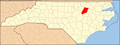
Nash County is located in North Carolina in the United States. Its county seat is Nashville.
Media in category "Maps of Nash County, North Carolina"
The following 23 files are in this category, out of 23 total.
-
-

-
 Map of North Carolina highlighting Nash County.svg 2,687 × 1,019; 157 KB
-
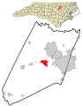
 Nash County North Carolina incorporated and unincorporated areas Bailey highlighted.svg 797 × 1,028; 25.79 MB
-

-

-

-
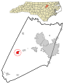
 Nash County North Carolina incorporated and unincorporated areas Momeyer highlighted.svg 797 × 1,028; 25.79 MB
-
-
 Nash County North Carolina incorporated and unincorporated areas Red Oak highlighted.svg 797 × 1,028; 25.79 MB
-

-
-
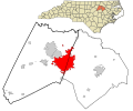
 Nash County North Carolina incorporated and unincorporated areas.svg 797 × 1,028; 25.79 MB
-
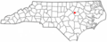 NCMap-doton-Bailey.PNG 300 × 117; 9 KB
-
 NCMap-doton-Castalia.PNG 300 × 117; 9 KB
-
 NCMap-doton-Middlesex.PNG 300 × 117; 9 KB
-
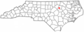 NCMap-doton-Momeyer.PNG 300 × 117; 9 KB
-
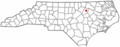
 NCMap-doton-Nashville.PNG 300 × 117; 9 KB
-
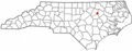
 NCMap-doton-RedOak.PNG 300 × 117; 9 KB
-
 NCMap-doton-Sharpsburg.PNG 300 × 117; 9 KB
-
 NCMap-doton-SpringHope.PNG 300 × 117; 9 KB
-
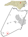
 North Carolina Map Highlighting Nash County.PNG 531 × 201; 15 KB
-
 Researchtrianglearea.png 500 × 187; 57 KB


