Category:Maps of Neuvelle-lès-Voisey
Wikimedia category | |||||
| Upload media | |||||
| Instance of | |||||
|---|---|---|---|---|---|
| Category combines topics | |||||
| Neuvelle-lès-Voisey | |||||
commune in Haute-Marne, France _la_Place_de_l%27_Eglise_en_1907.jpg)  | |||||
| Instance of | |||||
| Location |
| ||||
| Population |
| ||||
| Area |
| ||||
 | |||||
Media in category "Maps of Neuvelle-lès-Voisey"
The following 3 files are in this category, out of 3 total.
-
 52350-Neuvelle-lès-Voisey-Hydro.jpeg 5,846 × 4,133; 1.06 MB
-
 52350-Neuvelle-lès-Voisey-Sols.png 3,270 × 2,598; 962 KB
-
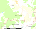 Map commune FR insee code 52350.png 756 × 605; 31 KB

